
Image: Columbus Crater Layers
No higher resolution available.
Columbus_Crater_Layers.JPG (630 × 379 pixels, file size: 44 KB, MIME type: image/jpeg)
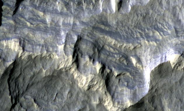
Description: Columbus Crater Layers, in false-color as seen by hirise. Location is 28.6 degrees south latitude and 194.3 degrees east longitude. Image was taken by the Mars Reconnaissance Orbiter's HiRISE. The HiRISE camera was built by Ball Aerospace and Technology Corporation and is operated by the University of Arizona. Image courtesy NASA/JPL/University of Arizona.
Usage Terms: Public domain
Image usage
The following page links to this image:

All content from Kiddle encyclopedia articles (including the article images and facts) can be freely used under Attribution-ShareAlike license, unless stated otherwise.