
Image: Concentration camps in occupied Europe (2007 borders)
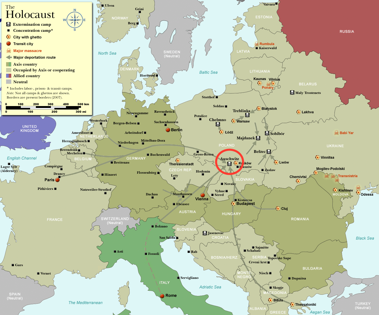
Description: Map of the Holocaust in Europe during World War II, 1939–1945. This map shows all extermination camps (or death camps), most major concentration camps, labor camps, prison camps, ghettos, major deportation routes and major massacre sites. Please note that a version with 1942 borders is available here: Image:WW2-Holocaust-Europe.png. Notes: 1. Extermination camps were dedicated death camps. 2. Concentration camps include labor camps, prison camps & transit camps. 3. Not all camps & ghettos are shown. 4. Borders are present borders (2007). Übersetzung der "Notes" bis hierher: 1. Extermination camps = Vernichtungslager als Fachbegriff für ganz bestimmte Konzentrationslager. 2. Concentration camps umfassen hier auch Arbeitslager, Gefängnislager und Transitlager. 3. Nicht alle Konzentrationslager werden gezeigt. 4. Die Namen der Konzentrationslager und die Pfeile für die Deportation sind in Karten des modernen Nachkriegseuropas eingetragen.
Title: Concentration camps in occupied Europe (2007 borders)
Credit: File:WW2-Holocaust-Europe-2007Borders.png
Author: User:Dna-Dennis
Usage Terms: Creative Commons Attribution 3.0
License: CC BY 3.0
License Link: https://creativecommons.org/licenses/by/3.0
Attribution Required?: Yes
Image usage
The following 2 pages link to this image:

.png)