
Image: Cook-Islands-map
No higher resolution available.
Cook-Islands-map.gif (325 × 350 pixels, file size: 5 KB, MIME type: image/gif)
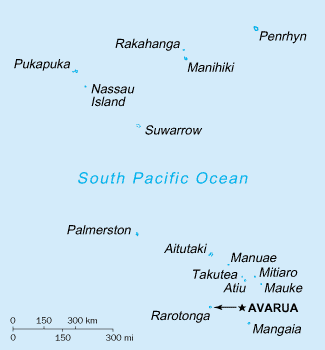
Description: A map of the Cook Islands, showing the capital and the names of the islands.
Title: Cook-Islands-map
Credit: CIA, The World Factbook, 2004.
Author: CIA
Permission: This image is in the public domain because it contains materials that originally came from the United States Central Intelligence Agency's World Factbook.
Usage Terms: Public domain
License: Public domain
Attribution Required?: No
Image usage
The following 3 pages link to this image:

All content from Kiddle encyclopedia articles (including the article images and facts) can be freely used under Attribution-ShareAlike license, unless stated otherwise.