
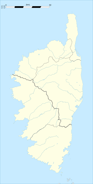
Image: Corse region location map

Description: Blank administrative map of the region of Corsica, France, for geo-location purpose, with distinct boundaries for departments and arrondissements as they are since January 2010. The former version of the map shows the boundaries as they were until December 2009.
Title: Corse region location map
Credit: Own work Shorelines : NASA Shuttle Radar Topography Mission (SWBD) (public domain) ; Additional reference for confirmation: Géoportail. Reference for the 2010 arrondissements boundaries: Arrêté préfectoral n° 2009-1508
Author: Eric Gaba (Sting - fr:Sting)
Permission: Attribution and Share-Alike required Any use of this map can be made as long as you credit me (Eric Gaba – Wikimedia Commons user: Sting) as the author and distribute the copies and derivative works under the same license(s) that the one(s) stated below. A message with a reply address would also be greatly appreciated.
Usage Terms: Creative Commons Attribution-Share Alike 3.0
License: CC BY-SA 3.0
License Link: http://creativecommons.org/licenses/by-sa/3.0
Attribution Required?: Yes
Image usage
The following 8 pages link to this image:
