
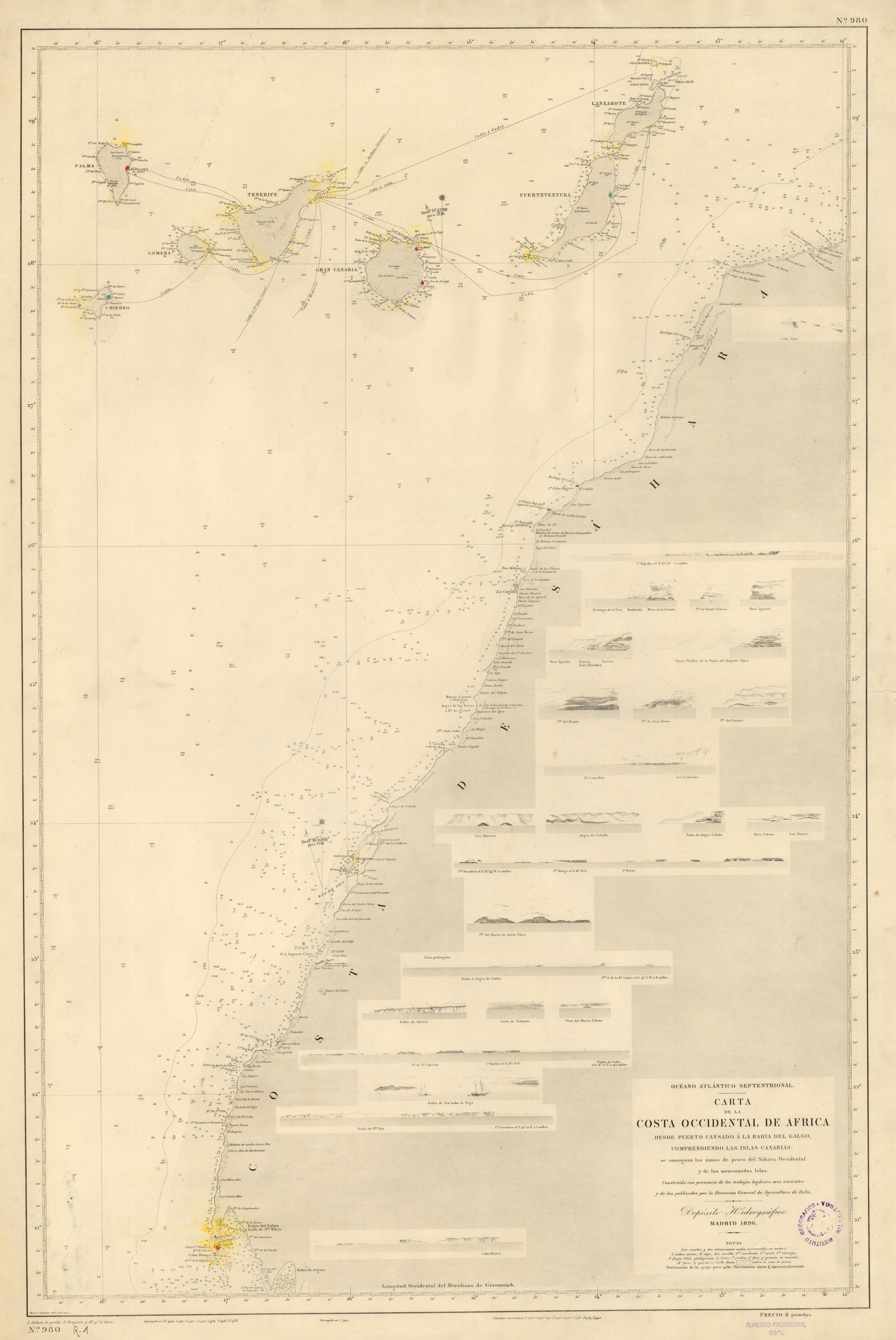
Image: CostaAOE1896g
Size of this preview: 401 × 599 pixels. Other resolutions: 160 × 240 pixels | 5,185 × 7,751 pixels.
Original image (5,185 × 7,751 pixels, file size: 5.32 MB, MIME type: image/jpeg)
Description: Map detailing the coastline of colonial Spanish Sahara in 1896.
Title: CostaAOE1896g
Credit: http://www.sahara-mili.net/afondo/mapas/CostaAOE1896g.jpg
Author: Depósito Hidrográfico, Madrid, 1896 (L. Galvan la grabó, S. Bregante la letra)
Usage Terms: Public domain
License: Public domain
Attribution Required?: No
Image usage
The following page links to this image:

All content from Kiddle encyclopedia articles (including the article images and facts) can be freely used under Attribution-ShareAlike license, unless stated otherwise.