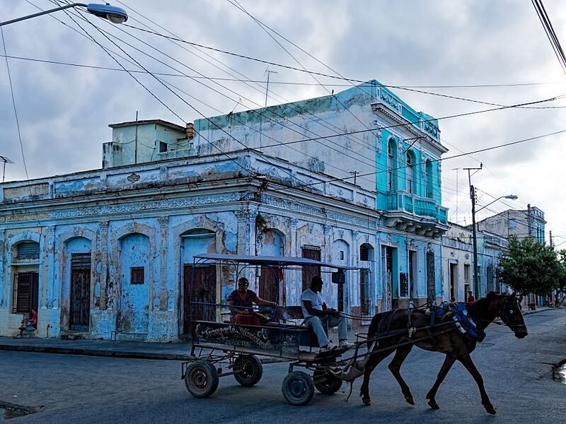
Image: Cuba 20160320 4849 Cienfuegos sRGB

Description: A horse-drawn ‘bus’ transporting people around Cienfuegos. Cienfuegos, known as the Pearl of the South (La Perla del Sur), is situated on an expansive natural bay ‘discovered’ by Columbus in 1494. The city was founded in 1819 by a French émigré from Louisiana who invited 40 families from New Orleans and Philadelphia as well as Bordeaux, France, to form a settlement here. Initially called Fernandina de Jagua (from the indigenous people’s name for the area) in honor of King Ferdinand VII of Spain, the city was renamed Cienfuegos after the governor of Cuba when the settlement had to rebuild following a hurricane in 1821. The city’s fortunes grew with the arrival of the railroad in the 1850s to be magnified by the migration of sugarcane growers from eastern Cuba into the surrounding area during the fourth quarter of the 19th century, making the Cienfuegos seaport the center of Cuba’s sugar trade along with coffee and tobacco. The Urban Historic Centre of Cienfuegos was declared a UNESCO World Heritage site in 2005 for its 19th-century urban planning and architecture. On Google Earth: Cienfuegos 22° 8'41.56"N, 80°27'8.23"W
Title: Cuba 20160320 4849 Cienfuegos sRGB
Credit: https://www.flickr.com/photos/9508280@N07/26690910873/
Author: Dan Lundberg
Usage Terms: Creative Commons Attribution-Share Alike 2.0
License: CC BY-SA 2.0
License Link: https://creativecommons.org/licenses/by-sa/2.0
Attribution Required?: Yes
Image usage
The following page links to this image:

