
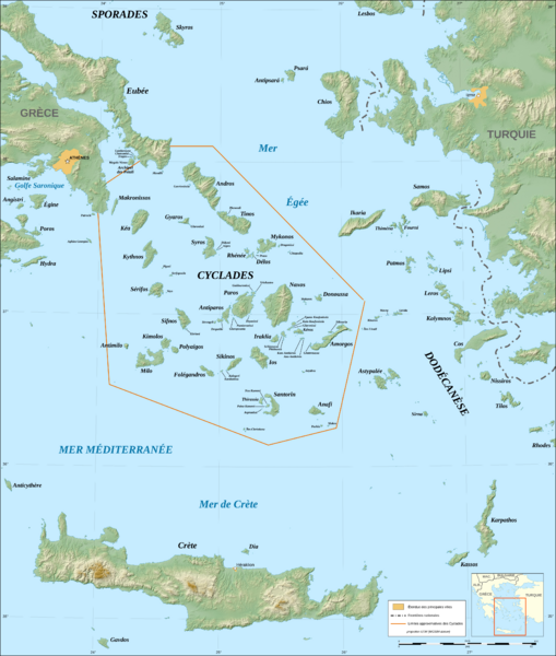
Image: Cyclades map-fr

Description: Map in French of the Cyclades islands, Greece. Note: The background map is a raster image embedded in the SVG file.
Title: Cyclades map-fr
Credit: Own work ; Topographic data : NASA Shuttle Radar Topography Mission (SRTM3 v.2) (public domain) edited with 3DEM from Visualization Software LLC ; Locator map : Image:Map_Greece_expansion_1832-1947-fr.svg (modified) created by Historicair ; Translation of the Greek names into French : fr:Cédric Boissière
Author: Eric Gaba (Sting - fr:Sting)
Permission: Attribution and Share-Alike required Any use of this map can be made as long as you credit me (Eric Gaba – Wikimedia Commons user: Sting) as the author, User:Historicair for the locator map, and distribute the copies and derivative works under the same license(s) that the one(s) stated below. A message with a reply address would also be greatly appreciated.
Usage Terms: Creative Commons Attribution-Share Alike 3.0
License: CC BY-SA 3.0
License Link: https://creativecommons.org/licenses/by-sa/3.0
Attribution Required?: Yes
Image usage
The following page links to this image:
