
Image: DEMVercors
Size of this preview: 545 × 600 pixels. Other resolutions: 218 × 240 pixels | 1,958 × 2,154 pixels.
Original image (1,958 × 2,154 pixels, file size: 1.45 MB, MIME type: image/png)
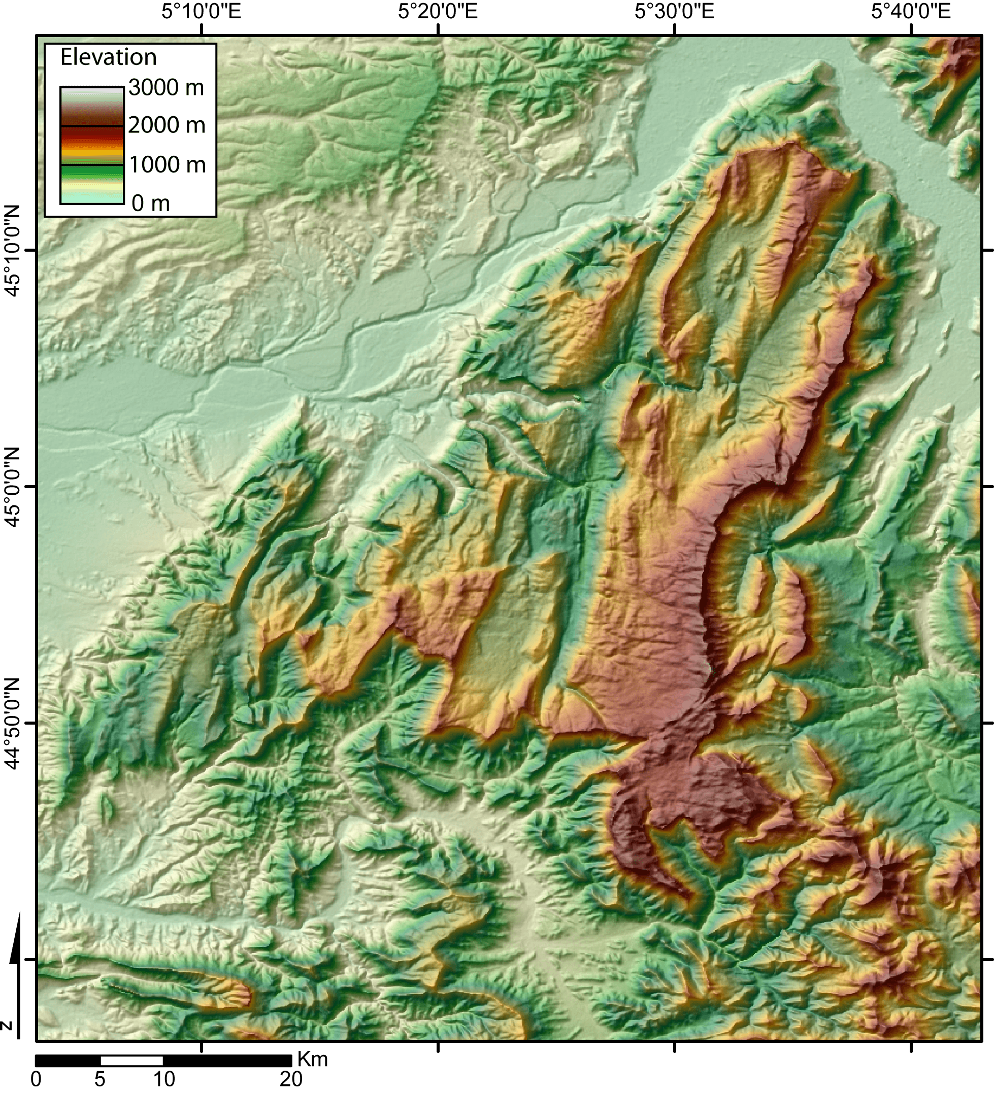
Description: Digital Elevation Model of the Vercors massif (French Alps) created by jide from the 90m pixel size SRTM dataset. The broad valley to the NW and NE is the Isere valley. The city of Grenoble lie in the Gresivaudan, at the NE of the Vercors massif.
Title: DEMVercors
Credit: No machine-readable source provided. Own work assumed (based on copyright claims).
Author: No machine-readable author provided. Jide~commonswiki assumed (based on copyright claims).
Usage Terms: Creative Commons Attribution-Share Alike 3.0
License: CC BY-SA 3.0
License Link: http://creativecommons.org/licenses/by-sa/3.0/
Attribution Required?: Yes
Image usage
The following page links to this image:

All content from Kiddle encyclopedia articles (including the article images and facts) can be freely used under Attribution-ShareAlike license, unless stated otherwise.