
Image: Da-ming-hun-yi-tu
Size of this preview: 683 × 600 pixels. Other resolutions: 273 × 240 pixels | 895 × 786 pixels.
Original image (895 × 786 pixels, file size: 493 KB, MIME type: image/jpeg)
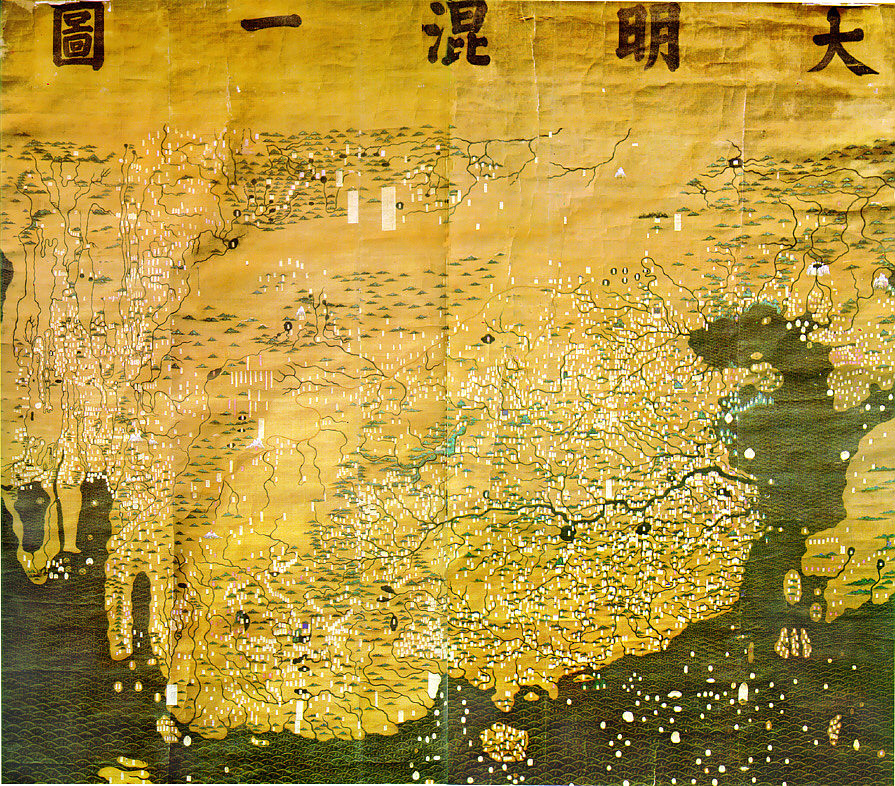
Description: The Composite Map of the Ming Empire (Da Ming Hunyi Tu) reflects the political situation in AD 1389 but was likely painted much later. Original Chinese labels were later covered with Manchu on paper slips.
Title: Da-ming-hun-yi-tu
Credit: http://geog.hkbu.edu.hk/GEOG1150/Chinese/Catalog/am31_map1.htm
Author: Chinese (image enhanced by contributor)
Usage Terms: Public domain
License: Public domain
Attribution Required?: No
Image usage
The following page links to this image:

All content from Kiddle encyclopedia articles (including the article images and facts) can be freely used under Attribution-ShareAlike license, unless stated otherwise.