
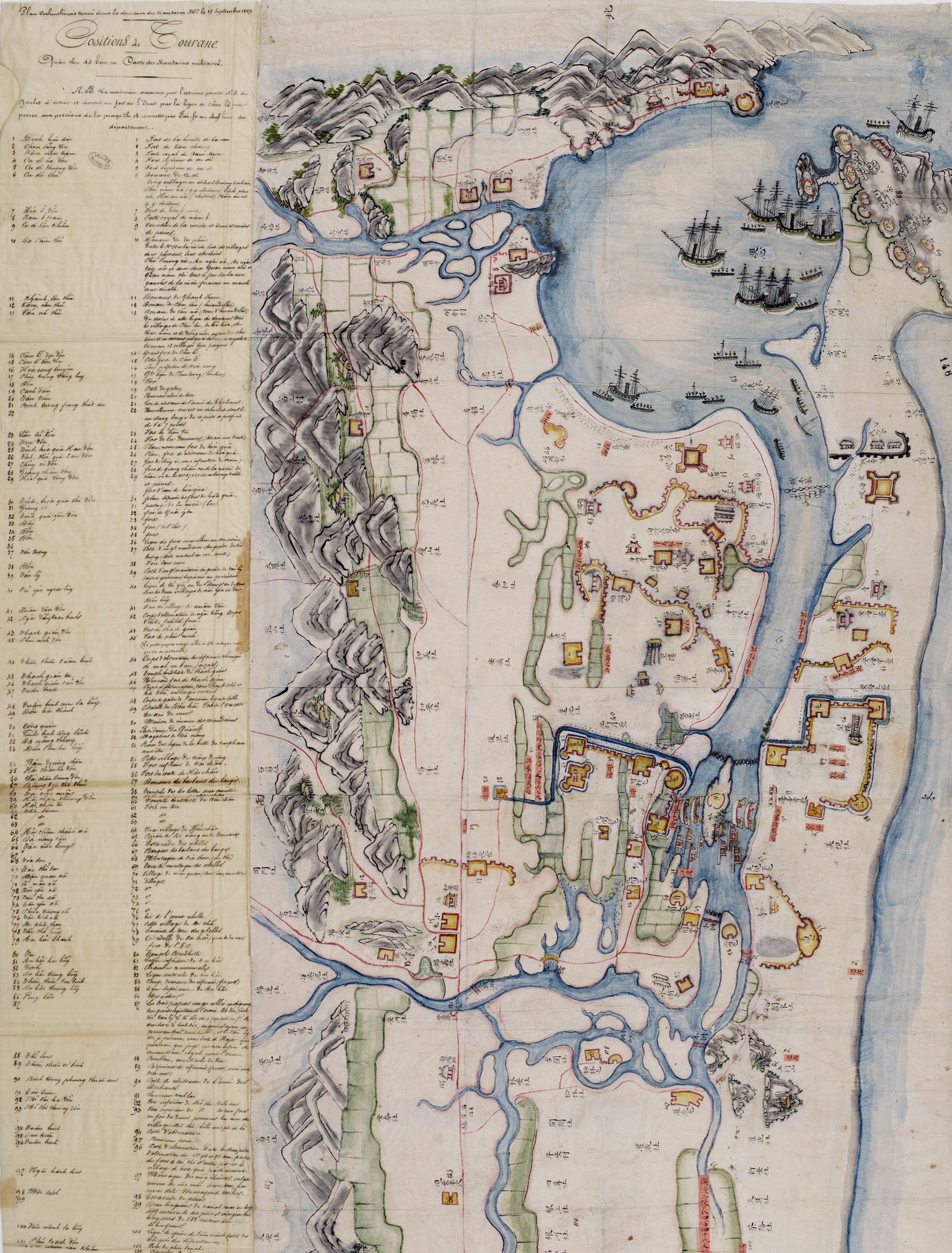
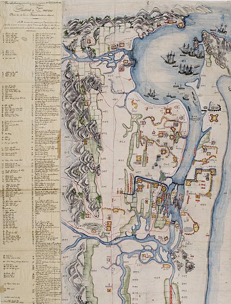
Image: DaNang1859
Size of this preview: 455 × 599 pixels. Other resolutions: 182 × 240 pixels | 2,000 × 2,633 pixels.
Original image (2,000 × 2,633 pixels, file size: 3.69 MB, MIME type: image/jpeg)
Description: Map of Tourane (Da Nang) found in the home of a mandarin of the Vietnamese military in 1859 (part 1). The map itself is at right, with annotations in Sino-Vietnamese script; a legend is at left, written in French.
Usage Terms: Public domain
Image usage
The following page links to this image:

All content from Kiddle encyclopedia articles (including the article images and facts) can be freely used under Attribution-ShareAlike license, unless stated otherwise.