
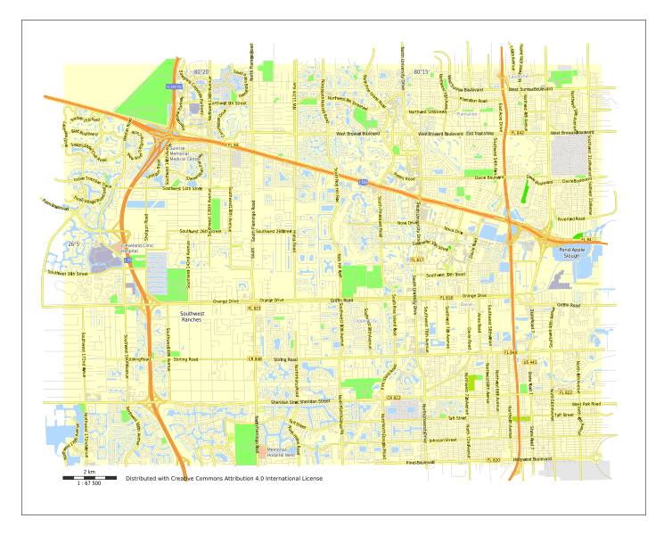
Image: Davie city map plan Florida USA

Size of this PNG preview of this SVG file: 754 × 600 pixels. Other resolution: 302 × 240 pixels.
Original image (SVG file, nominally 1,484 × 1,180 pixels, file size: 2.03 MB)
Description: Davie city map plan, Florida, USA, 12 level (5 km scale)
Title: Davie city map plan Florida USA
Credit: I draw maps Previously published: http://vectormap.info/free_vector_maps_downloads/davie-florida-us-free-vector-map-adobe-illustrator/
Author: Ilya Shrayber
Usage Terms: Creative Commons Attribution-Share Alike 4.0
License: CC BY-SA 4.0
License Link: http://creativecommons.org/licenses/by-sa/4.0
Attribution Required?: Yes
Image usage
The following page links to this image:

All content from Kiddle encyclopedia articles (including the article images and facts) can be freely used under Attribution-ShareAlike license, unless stated otherwise.