
Image: Delaware and Hudson Canal Map
Size of this preview: 705 × 600 pixels. Other resolutions: 282 × 240 pixels | 1,100 × 936 pixels.
Original image (1,100 × 936 pixels, file size: 672 KB, MIME type: image/png)
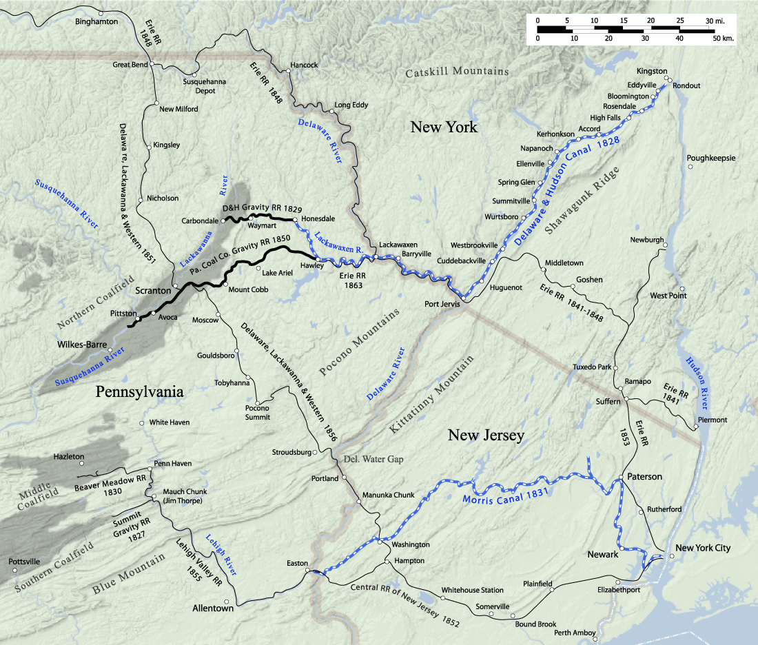
Description: Early transportation lines to the northern Pennsylvania anthracite coal fields, circa 1865, including the Delaware and Hudson canal, Delaware, Lackawanna and Western Railroad, Lehigh Valley Railroad, Erie Railroad, Central Railroad of New Jersey, Morris canal, and gravity railroads.
Title: Delaware and Hudson Canal Map
Credit: Own work
Author: JimIrwin
Usage Terms: Creative Commons Attribution 3.0
License: CC BY 3.0
License Link: https://creativecommons.org/licenses/by/3.0
Attribution Required?: Yes
Image usage
The following page links to this image:

All content from Kiddle encyclopedia articles (including the article images and facts) can be freely used under Attribution-ShareAlike license, unless stated otherwise.