
Image: Dengue06
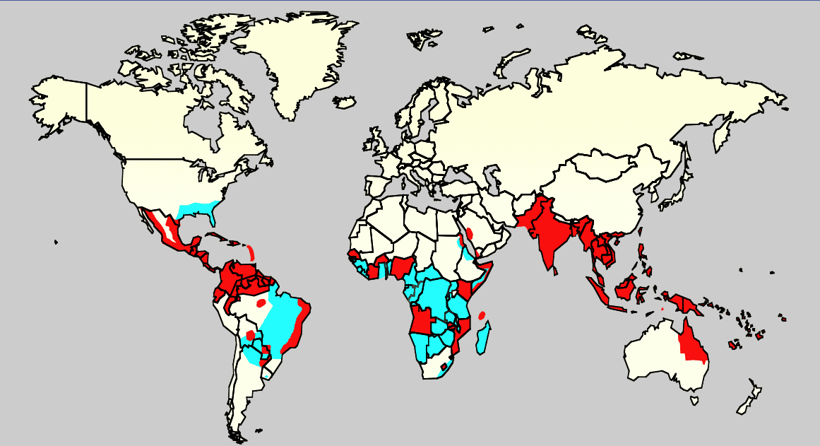
Description: Map showing the distribution of dengue fever in the world, as of 2006. Map produced by the Agricultural Research Service of the US Department of Agriculture. Key: Cyan: Areas infested with Aedes aegypti Red: Areas with Aedes aegypti and recent epidemic dengue fever.
Title: Dengue06
Credit: Own work using: Slide #8 of a presentation by Gary G. Clark, PhD, entitled "Dengue: An emerging arboviral disease".Referencias Celeste: Monday/OClubMorning/TRIServiceDENemergingJAX2007.ppt Áreas infectadas con el mosquito 'Aedes aegyptis Rojo: Áreas que estan infectadas con el mosquito Aedes Aegyptis y que tienen una reciente expansión epidémica.
Author: Unknown authorUnknown author
Usage Terms: Public domain
License: Public domain
Attribution Required?: No
Image usage
The following page links to this image:
