
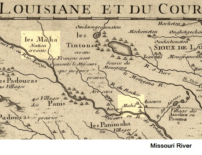
Image: Detail of the 1718 De L'isle map. Location of Maha (the Omaha Indians) and Les Maha Nation errente
No higher resolution available.
Detail_of_the_1718_De_L'isle_map._Location_of_Maha_(the_Omaha_Indians)_and_Les_Maha_Nation_errente.png (660 × 507 pixels, file size: 657 KB, MIME type: image/png)
Description: Detail of 1718 map by French cartographer De L'isle with Middle and Upper Missouri River. Villages of the Maha (Omaha Indians) and the Iowa Indians as well as main area of "Les Omaha Nation errante" (The wandering Omaha) located.
Title: Detail of the 1718 De L'isle map. Location of Maha (the Omaha Indians) and Les Maha Nation errente
Credit: Congress Public Domain. http://hdl.loc.gov/loc.gmd/g3700.ct000666
Author: Guillaume De L'isle (1675-1726?)
Usage Terms: Public domain
License: Public domain
Attribution Required?: No
Image usage
The following page links to this image:

All content from Kiddle encyclopedia articles (including the article images and facts) can be freely used under Attribution-ShareAlike license, unless stated otherwise.
_and_Les_Maha_Nation_errente.png)