
Image: Detailed-Descriptions-of-Woodbridge-Townships-Floodplains
Size of this preview: 451 × 599 pixels. Other resolutions: 181 × 240 pixels | 648 × 861 pixels.
Original image (648 × 861 pixels, file size: 375 KB, MIME type: image/jpeg)
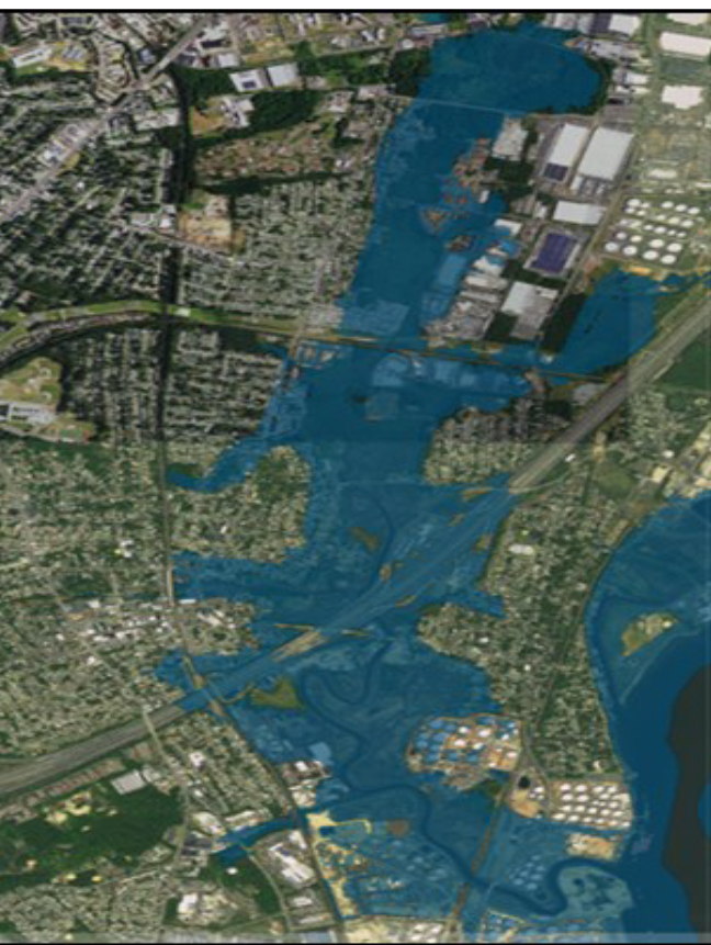
Description: Woodbridge, New Jersey, area inundated by Woodbridge River after Hurricane Sandy (Center blue area) woodbridge river
Title: Detailed-Descriptions-of-Woodbridge-Townships-Floodplains
Credit: https://www.twp.woodbridge.nj.us/DocumentCenter/View/8040/Detailed-Descriptions-of-Woodbridge-Townships-Floodplains
Author: USGS. This is a USGS Sandy Storm Tide Mapper
Usage Terms: Public domain
License: Public domain
Attribution Required?: No
Image usage
The following page links to this image:

All content from Kiddle encyclopedia articles (including the article images and facts) can be freely used under Attribution-ShareAlike license, unless stated otherwise.