
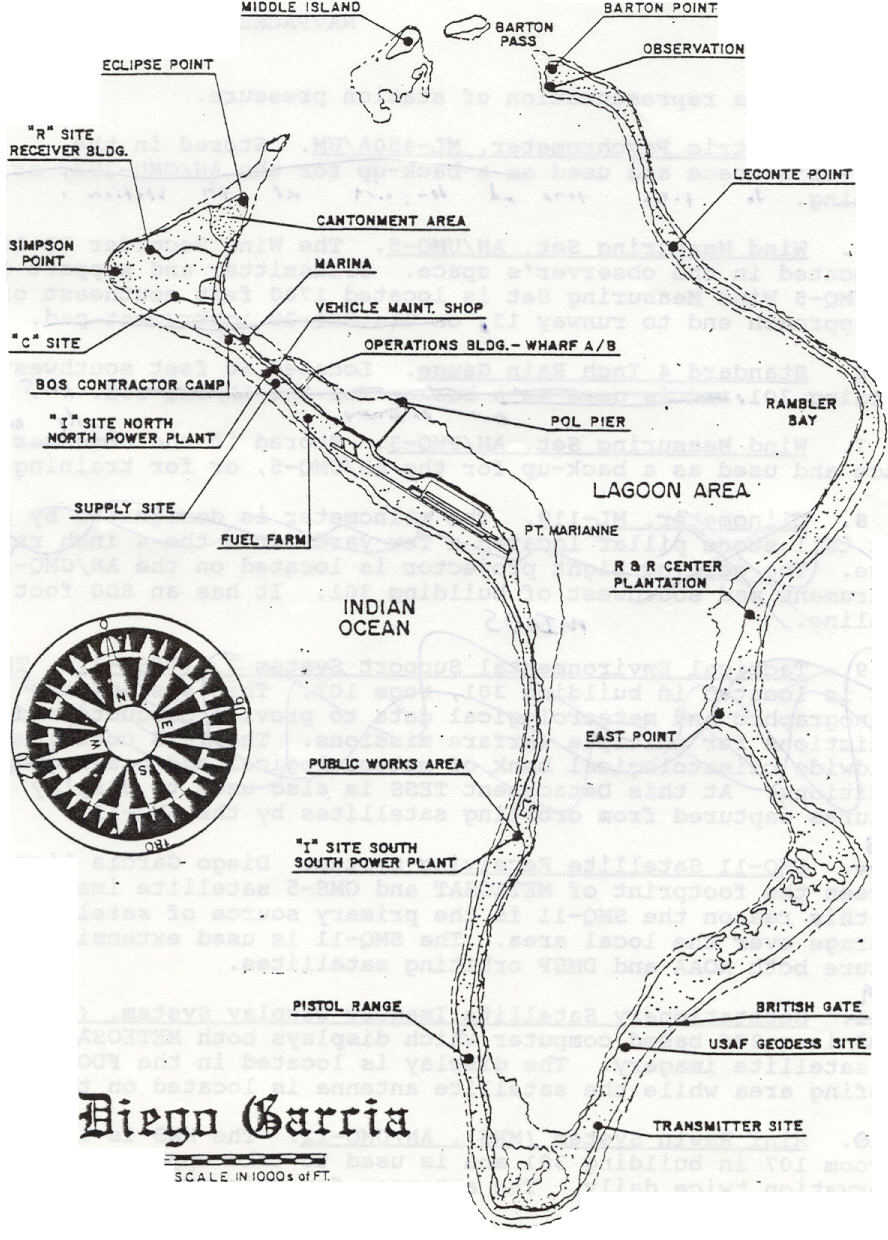
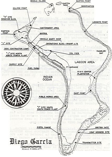
Image: Diego Garcia Island Map
Size of this preview: 429 × 599 pixels. Other resolutions: 172 × 240 pixels | 888 × 1,240 pixels.
Original image (888 × 1,240 pixels, file size: 203 KB, MIME type: image/jpeg)
Description: Diego Garcia Island Map, from around 2002. This is "FIGURE 2: Diego Garcia Island Map" from the source document, 'Local Area Forecaster's Handbook for Diego Garcia'.
Title: Diego Garcia Island Map
Credit: http://www.globalsecurity.org/military/library/report/2002/diego-fdo-handbook.doc (NAVCENTMETOCDETDGINST 3140.2 05 APR 2002)
Author: US Navy (Naval Central Meteorology and Oceanography Detachment, Diego Garcia)
Usage Terms: Public domain
License: Public domain
Attribution Required?: No
Image usage
The following page links to this image:

All content from Kiddle encyclopedia articles (including the article images and facts) can be freely used under Attribution-ShareAlike license, unless stated otherwise.