
Image: Dingle Way north of Ballinknockane - geograph.org.uk - 466407
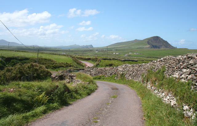
Description: Dingle Way north of Ballinknockane The Dingle Way runs along a lane north of the hamlet of Ballinknockane (Baile an Chnocain). The dip in the road conceals a stream, one of many descending from Brandon Mountain (Cnoc Breanainn) in this area. In the distance, Ballydavid Head (Ceann Bhaile Dhaith; right), The Three Sisters (An Triur Deirfear) and Sibyl Point (Ceann Sibeal; centre) can all be seen, with the Skellig islands faintly visible on the horizon (centre left)
Title: Dingle Way north of Ballinknockane - geograph.org.uk - 466407
Credit: From geograph.org.uk
Author: Espresso Addict
Usage Terms: Creative Commons Attribution-Share Alike 2.0
License: CC BY-SA 2.0
License Link: https://creativecommons.org/licenses/by-sa/2.0
Attribution Required?: Yes
Image usage
The following page links to this image:
