
Image: Distancia a la costa
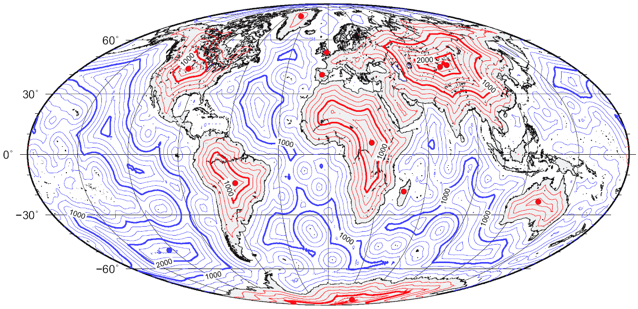
Description: Map of great-circle distance to the coastline.
Title: Distancia a la costa
Credit: self-made using the technique described in Garcia-Castellanos, D., & U. Lombardo, 2007. Poles of Inaccessibility: a calculation algorithm for the remotest places on Earth. Scott. Geogr. J., 123, 227-233. Based on the coastline database of Wessel, P. & Smith, W. H. F. (1996) A global self-consistent, hierarchical, high-resolution shoreline database, Journal of Geophysical Research, 101, B4, 8741 – 8743. Lake shores are excluded.
Author: Gaianauta
Usage Terms: Creative Commons Attribution-Share Alike 4.0
License: CC BY-SA 4.0
License Link: https://creativecommons.org/licenses/by-sa/4.0
Attribution Required?: Yes
Image usage
The following page links to this image:
