
Image: Districts of Mi'kma'ki
Size of this PNG preview of this SVG file: 512 × 512 pixels. Other resolution: 240 × 240 pixels.
Original image (SVG file, nominally 512 × 512 pixels, file size: 98 KB)
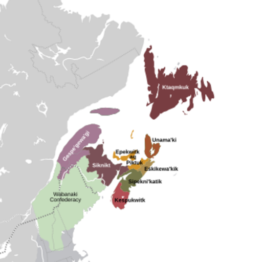
Description: The eight districts of Mi'kma'ki: (Light-Purple) Gespe'gewa'gi. (Dark-Purple) Siknikt. (Yellow) Epekwitk aq Piktuk. (Dark-Green) Sipekni'katik. (Light-Red) Kespukwitk. (Tan) Eskikewa'kik. (Orange) Unama'ki, the capital district of Mi'kma'ki. (Dark-Red) Ktaqmkuk. (Light-Green) The other national territories of the Wabanaki Confederacy. (Dark-Grey) The southern territories of the Dawnland region. (Light-Grey) Turtle Island (North America).
Usage Terms: Public domain
Image usage
The following page links to this image:

All content from Kiddle encyclopedia articles (including the article images and facts) can be freely used under Attribution-ShareAlike license, unless stated otherwise.