
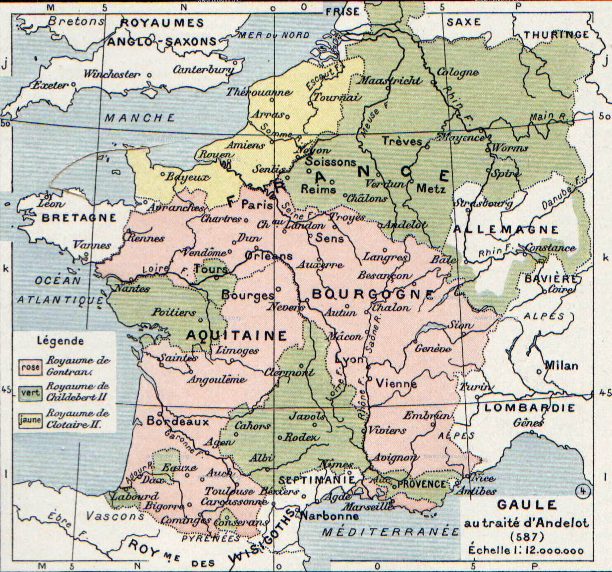
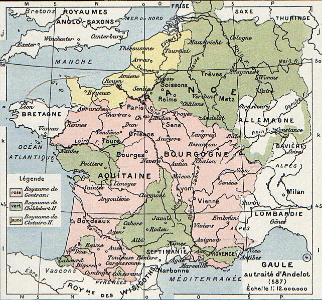
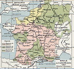
Image: Division of Gaul - 587
Size of this preview: 642 × 599 pixels. Other resolutions: 257 × 240 pixels | 1,235 × 1,153 pixels.
Original image (1,235 × 1,153 pixels, file size: 357 KB, MIME type: image/jpeg)
Description: The map comes from Vidal-Lablache, Atlas général d'histoire et de géographie (1894). It shows Gaul in 587 AD.
Title: Division of Gaul - 587
Credit: Paul Vidal de La Blache, Atlas général d'histoire et de géographie (1894).
Author: Paul Vidal de La Blache
Usage Terms: Public domain
License: Public domain
Attribution Required?: No
Image usage
The following 2 pages link to this image:

All content from Kiddle encyclopedia articles (including the article images and facts) can be freely used under Attribution-ShareAlike license, unless stated otherwise.