
Image: Dixon entrance boundary dispute
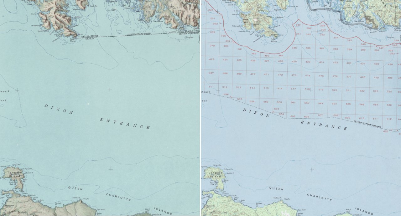
Description: Dixon Entrance, Northwestern America. An illustration of the boundary dispute by showing the different notions of the U.S.-Canadian boundary on two maps provided by the U.S. Dept. of the Interior Geological Survey (enlarged detail of original material). The left side shows the 1903 AB-Line (dashed line in the upper third) and the right side the U.S. notion of the “limit of exclusive economic zone” (dashed black line near the label ‘Dixon Entrance’).
Title: Dixon entrance boundary dispute
Credit: Both source maps are from the US Geological Survey 1:250,000 series of Alaska; available online at the University of Texas Perry-Castañeda Library Map Collection 1959 map (jpg 3.4 MB) 1985 map (jpg 5.4 MB)
Author: Carsten Finis
Permission: Source Material: http://www.lib.utexas.edu/maps/faq.html#3.html
Usage Terms: Public domain
License: Public domain
Attribution Required?: No
Image usage
The following page links to this image:
