Dixon Entrance facts for kids
The Dixon Entrance is a large body of water in the Pacific Ocean. It is about 80 kilometers (50 miles) long and wide. This strait sits right on the border between the U.S. state of Alaska and the province of British Columbia in Canada.
The Dixon Entrance is an important part of the Inside Passage. This is a shipping route used by many boats. It also forms part of the water border between the U.S. and Canada. However, the exact location of this border in the Dixon Entrance has been a topic of disagreement for a long time.
Contents
What's in a Name?
The Dixon Entrance was named by Joseph Banks. He named it after Captain George Dixon. Captain Dixon was a Royal Navy officer and explorer. He explored this area in 1787.
The Haida language has its own name for this strait. They call it Seegaay, which means "ocean."
Where is it Located?
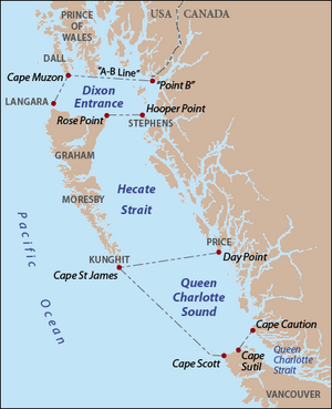
The Dixon Entrance is found between two main areas. To the north, you'll find Clarence Strait in the Alexander Archipelago of Alaska. To the south are Hecate Strait and the islands known as Haida Gwaii. These islands are also called the Queen Charlotte Islands and are part of British Columbia.
Prince of Wales Island in Alaska is the largest island on the northern side. The Kaigani Haida people live on this island. Members of the Haida nation can travel freely across the strait.
Some major water areas flow into the Dixon Entrance. These include Portland Inlet, Prince Rupert Harbour, and Masset Inlet.
The Border Disagreement
There is a special line called the "A–B" line. This line marks the northern part of the Dixon Entrance. It was drawn after a meeting in 1903 about the Alaska border.
The meaning of this "A–B" line is still debated by Canada and the United States. Canada believes this line is the official water border. This would mean it divides things like fishing areas.
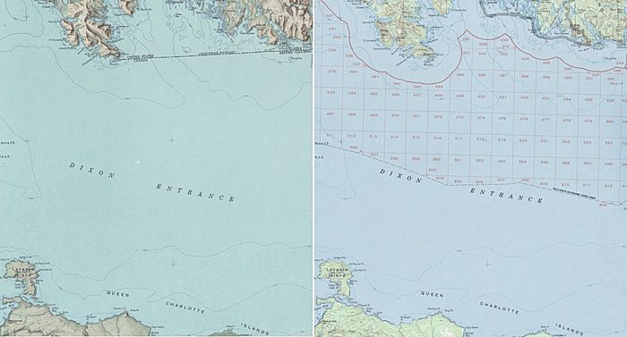
However, the United States thinks the line was only meant to show which land belonged to each country. So, the U.S. does not see the "A–B" line as a real border for things like ocean resources or fishing rights. In 1977, the U.S. drew its own water border. This new line was drawn to be equally far from the land of both countries.
Areas of Disagreement
Because of these two different border lines, there are four areas of water with unclear ownership.
- Two areas south of the "A–B" line are claimed by both countries. These are quite large, about 2,789 square kilometers (1,077 sq mi) and 51.5 square kilometers (20 sq mi).
- The other two areas are north of the "A–B" line. Neither country claims these smaller areas. They are about 72 square kilometers (28 sq mi) and 1.4 square kilometers (0.54 sq mi).
This disagreement means that fishing rights are still a problem between the two countries. The United States has never shown the "A–B" line as an official border on its government maps.
See also
 In Spanish: Entrada Dixon para niños
 | Audre Lorde |
 | John Berry Meachum |
 | Ferdinand Lee Barnett |


