Masset Inlet facts for kids
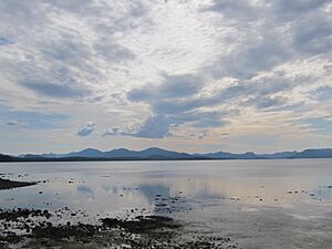
Masset Inlet is a big saltwater bay found in the northern part of Graham Island. This island is the largest and most northern of the Haida Gwaii islands, which are located off the coast of British Columbia, Canada. The inlet gets its water from several rivers, with the Yakoun River being the biggest. It connects to the open ocean of the Dixon Entrance through a narrow passage called Masset Sound and Masset Harbour.
Contents
Discovering Masset Inlet
Masset Inlet is a large body of water that stretches deep into Graham Island. It's like a big arm of the ocean reaching inland. This inlet helps to form a narrow strip of land called an isthmus on the Naikoon Peninsula.
Where is Masset Inlet?
Masset Inlet is located in a flat, low-lying area on northern Graham Island. This island is part of the beautiful Haida Gwaii archipelago. Several small towns are found along the shores of Masset Inlet. These include Port Clements and Sewall. Another community, Juskatla, is located on Juskatla Inlet, which is the largest branch of Masset Inlet.
Islands in the Inlet
Inside Masset Inlet, you'll find a few islands. The biggest one is Kumdis Island. It's located near where the inlet narrows to connect with Masset Sound, just north of Port Clements.
The Story Behind the Name
The name "Masset" has an interesting history. According to a historian named John Thomas Walbran, the name "Masset" (which also applies to Masset Island, Masset Sound, and the village of Masset) comes from the Haida word Masst. This word means "large island."
Early Explorers and Names
Captain Douglas was an early explorer who visited the area on June 19, 1789. He named the bay leading to the inlet McIntyre's Bay. This name was later used on maps made by other explorers like Dixon and Meares. American traders had their own name for the inlet, calling it Hancock's River. This name appeared on a map in 1792 and was named after an American ship called the Hancock.
British Surveys and the Name Masset
In 1853, H.N. Knox of the Royal Navy, who was a mate on the ship HMS Virago, made a basic map of the harbour. It was around this time that the name "Masset" was officially adopted by the British. Later, in 1907, Captain Learmouth conducted a more detailed survey of the area aboard his ship, HMS Egeria.
 | Selma Burke |
 | Pauline Powell Burns |
 | Frederick J. Brown |
 | Robert Blackburn |


