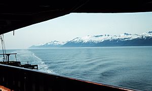
Clarence Strait facts for kids
Clarence Strait is a long, narrow body of water in southeastern Alaska, in the United States. It is part of the Alexander Archipelago, a group of islands along the coast. This strait separates Prince of Wales Island on its western side from Revillagigedo Island and Annette Island on its eastern side. Clarence Strait is about 126 miles (203 kilometers) long. It stretches from Dixon Entrance in the south to Sumner Strait in the north. Moira Sound is a smaller body of water found on the west side of the strait.
History of the Name
Clarence Strait was named in 1793 by George Vancouver. He was a British explorer who mapped many parts of the Pacific coast. Vancouver named the strait in honor of Prince William, Duke of Clarence. Prince William later became King William IV of the United Kingdom. Before Vancouver, another explorer named Jacinto Caamaño explored this area in 1792. Caamaño, a Spanish naval officer, had named the strait "Entrada de Nuestra Senora del Carmen."
Important Lighthouses
In the past, before modern navigation tools, lighthouses were very important. The Guard Island Light and Lincoln Rocks Light are two lighthouses located near Clarence Strait. They helped ships navigate safely through the waters. These lights were crucial guides for sailors, especially at night or in bad weather.
Swimming Across the Strait
Clarence Strait is a challenging body of water to swim across. The first person to successfully swim across Clarence Strait was Michelle Macy. She completed this amazing feat on July 5, 2010. Her swim took 6 hours and 46 minutes.
See also
 In Spanish: Estrecho Clarence para niños
 | Valerie Thomas |
 | Frederick McKinley Jones |
 | George Edward Alcorn Jr. |
 | Thomas Mensah |


