
Image: Dredging operations in Potomac River - 1930
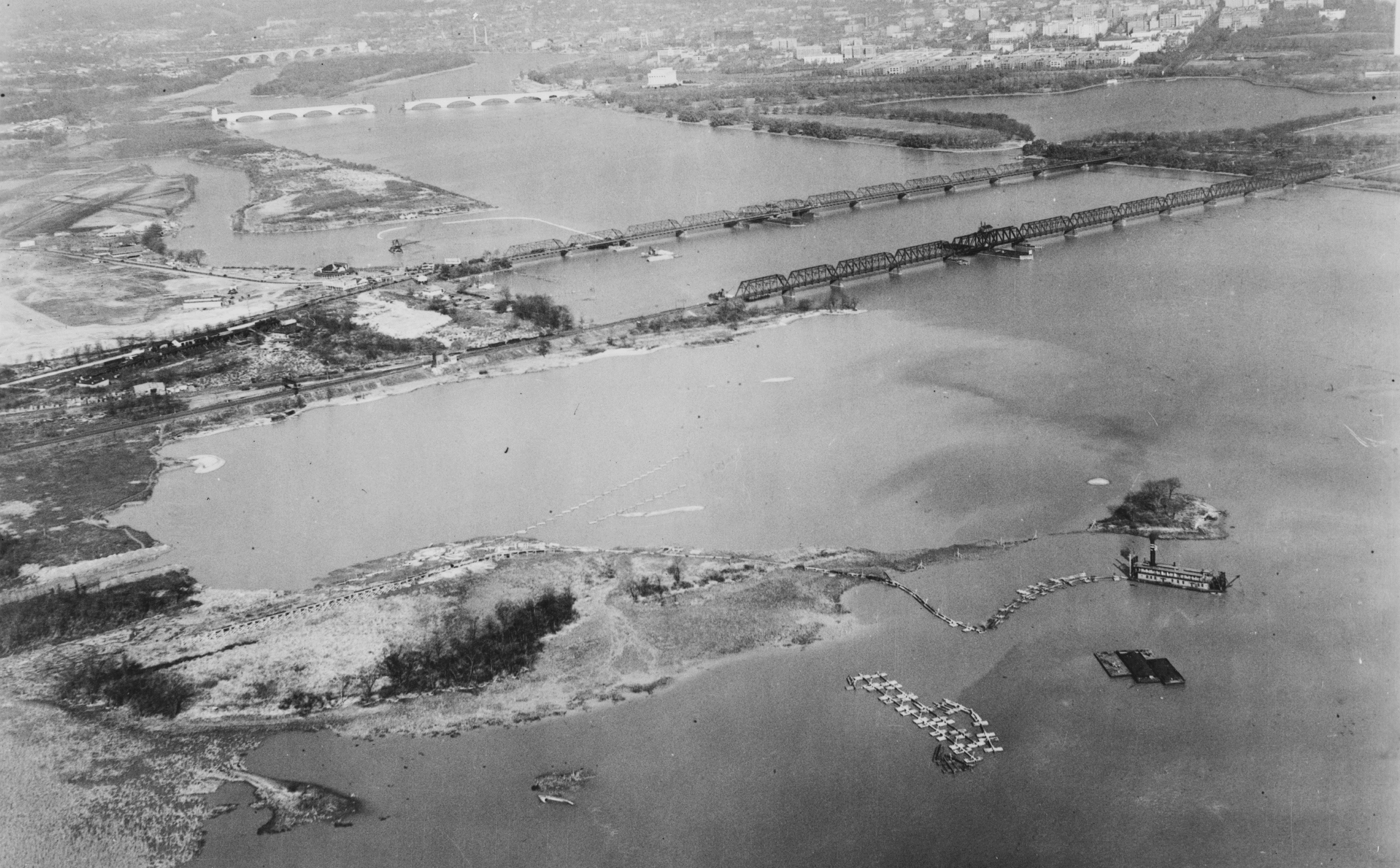
Description: Dredging operations in the Potomac River in Washington, D.C., in the United States in 1930. The double-bridge in the center is the Highway Bridge (later replaced, and today known as the 14th Street Bridges). Boot-shaped Columbia Island, Arlington Memorial Bridge, Theodore Roosevelt Island, and Francis Scott Key Bridge are visible upstream (to the left and top of the image). Note the pontoons between Columbia Island the north span of Highway Bridge, middle left. They indicate the area to be filled with dredged material from the Potomac River to create what will eventually be called the Pentagon Lagoon, and to narrow the outlet from Boundary Channel to the Potomac River. This will also allow the Mount Vernon Memorial Parkway (later named the George Washington Memorial Parkway) to be built along the axis of Columbia Island, cross the outlet channel, and proceed south below the soon-to-be-replaced Highway Bridge. Note the parallel pontoons in the lagoon south of Highway Bridge. They indicate where dredged material from the Potomac River will be placed to allow the parkway to continue south. The lagoon is the wide mouth of Roaches Run, a creek in Virginia. A large dredge can be seen tied up at the pier near the spit of land extending into the Potomac River. Several barges (to hold the material dredged up) are also nearby.
Title: Dredging operations in Potomac River - 1930
Credit: https://www.loc.gov/pictures/item/va1677.photos.368605p/
Author: Historic American Engineering Record, Library of Congress
Usage Terms: Public domain
License: Public domain
Attribution Required?: No
Image usage
The following 2 pages link to this image:
