
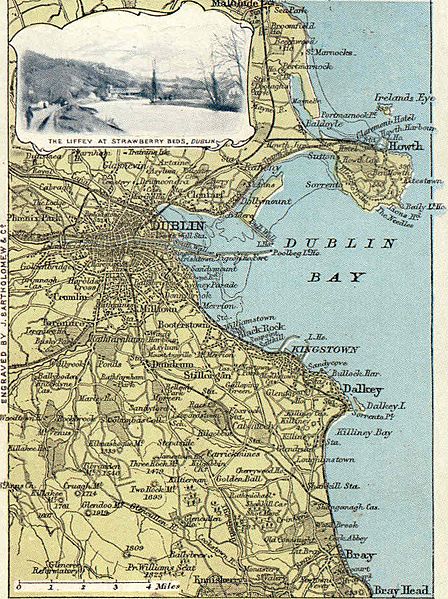
Image: Dublin area (Ireland) map from late 19th century postcard

Size of this preview: 448 × 599 pixels. Other resolutions: 179 × 240 pixels | 778 × 1,040 pixels.
Original image (778 × 1,040 pixels, file size: 654 KB, MIME type: image/jpeg)
Description: Dublin area, Ireland - postcard map showing the bulk of the middle and south county, including railways and other links, with an inset of the Strawberry Beds along the Liffey.
Title: Dublin area (Ireland) map from late 19th century postcard
Credit: Postcard in family album
Author: Anonymous employee of Bartholomew
Permission: Own scan of PD work, freely reuseable.
Usage Terms: Public domain
License: Public domain
Attribution Required?: No
Image usage
The following 2 pages link to this image:

All content from Kiddle encyclopedia articles (including the article images and facts) can be freely used under Attribution-ShareAlike license, unless stated otherwise.
_map_from_late_19th_century_postcard.jpg)