
Dublin Bay facts for kids
Quick facts for kids Dublin Bay |
|
|---|---|
_map_from_late_19th_century_postcard.jpg)
Map from late 19th-century postcard
|
|

Dublin Bay
Location in Dublin
|
|
| Coordinates | 53°20′N 6°07′W / 53.333°N 6.117°W |
| Part of | Irish Sea |
| Primary inflows | |
| Settlements | Dublin, Dún Laoghaire |

Dublin Bay (Irish: Cuan Bhaile Átha Cliath) is a C-shaped part of the Irish Sea. It is located on the east coast of Ireland. The bay is about 10 kilometres (6.2 miles) wide from north to south. It stretches 7 kilometres (4.3 miles) inland towards the city of Dublin.
The bay reaches from Howth Head in the north to Dalkey Point in the south. North Bull Island is in the northwest part of the bay. It has a 5-kilometre (3.1-mile) long sandy beach called Dollymount Strand. This area is also a special place for wild birds.
Many rivers from Dublin flow into the Irish Sea at Dublin Bay. These include the River Liffey, the River Tolka, and several smaller rivers and streams. The city of Dublin surrounds the bay on three sides: north, west, and south. The Irish Sea is to the east.
The city of Dublin was started by the Vikings. They built a bridge across the River Liffey near where it met the sea. Over time, the city grew along the coastline.
UNESCO has named Dublin Bay a 'biosphere reserve'. This means it's a special place because of its unique plants, animals, and natural habitats. The bay also has other important protections.

Contents
Exploring Dublin Bay
Dublin Bay is quite shallow. It has many sandbanks and rocky areas. In the past, this made it a dangerous place for ships, especially when the wind blew from the east. Many ships were lost close to shore. Old maps of the bay show special narrow paths for ships to follow.
Sandbanks and Islands
The bay used to have two main sandbanks, the North Bull and the South Bull. After the Bull Wall was built, the North Bull grew quickly. It became North Bull Island. A wall was also built in the south, called the Great South Wall. However, this wall did not create an island. The South Bull is still an area of mud flats and sand today. There are also sandbanks further out in the sea, like Kish Bank, which has a lighthouse.
The Coastline
Along the coast of Dublin Bay, you can find beaches. These include Sutton Strand, Dollymount Strand on North Bull Island, Sandymount, Seapoint, and beaches south of Dun Laoghaire. Other parts of the coast are rocky, like the cliffs on Howth Head. Some areas have mud leading up to sea walls. Most of the land gently slopes down to the sea. However, there are steeper slopes in places like Raheny, Monkstown, and Old Dunleary.
Rivers Flowing In
The most important river flowing into Dublin Bay is the River Liffey. It carries water from many smaller rivers like the Dodder, Poddle, and Camac. The River Tolka is the second largest river by volume. It enters the bay between East Wall and Clontarf. Other smaller streams also flow into the bay. In recent years, the water quality of the Liffey and Tolka rivers has greatly improved.
Poolbeg Chimneys
A very noticeable part of the bay's skyline are the tall chimneys of the Poolbeg Generating Station. These chimneys are 207 metres (679 feet) high. They have been a protected structure since 2014.
History of the Bay
In the early 1800s, William Bligh (famous from the Mutiny on the Bounty) mapped Dublin Bay. He also suggested ways to improve Dublin Port and build a safe harbour at Dún Laoghaire.
A sad event happened on October 10, 1918. The RMS Leinster was a steamship that was sunk by a German U-boat (submarine). Over 500 people, mostly soldiers, were lost. The ship now rests in 33 metres (108 feet) of water.
Over the years, there have been many discussions about protecting Dublin Bay. For example, in 1972, there was a plan to build an oil refinery in the bay. Many people, including a local politician named Seán D. Loftus, strongly opposed this plan. They were worried about pollution. Seán D. Loftus even changed his name to "Seán Dublin Bay Loftus" to show how much he cared about the bay. Thanks to these efforts, the plan for the refinery was stopped.
Later, the Dublin Port Company wanted to fill in parts of the bay. This idea was also met with strong opposition from local residents and environmental groups. In 2010, the plan was refused because it might harm the bay's natural heritage and protected areas. These efforts show how important Dublin Bay is to the people of Ireland.
Shipping and Travel
Dublin Bay is a busy place for ships. Many cargo ships, passenger ferries, and cruise ships use the bay. The port authority helps guide ships safely. Several lighthouses, including those managed by the Commissioners of Irish Lights (whose main office is in Dún Laoghaire), help ships navigate the waters.
Flooding Concerns
Sometimes, during very high tides, parts of the coast can experience Coastal flooding. This can happen in areas like Clontarf and Sandymount.
Protecting the Bay
Many parts of Dublin Bay are officially protected. These protections help keep the bay's unique environment safe. Some of these special designations include:
- Proposed NHA (Natural Heritage Area) for North and South Dublin Bay.
- Special Area of Conservation for North and South Dublin Bay.
- Special Protection Area for North Bull Island and the area from the River Tolka estuary to Sandymount Strand.
- Ramsar and Biosphere Reserve status for North Bull Island.
Fun Activities
Dublin Bay is a great place for many fun activities! People enjoy swimming, kayaking, yachting, kite-surfing, and diving in the bay.
Images for kids
-
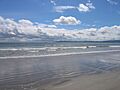
Dublin's bay viewed from Dollymount Strand.

See also
 In Spanish: Bahía de Dublín para niños
