River Poddle facts for kids
Quick facts for kids River Poddle |
|
|---|---|
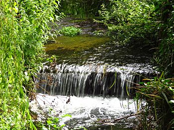
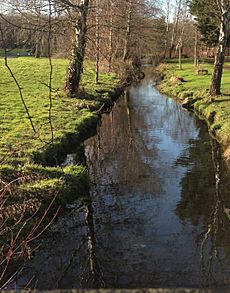
River Poddle at Poddle Park in Kimmage
|
|
 |
|
| Native name | An Poitéal |
| Physical characteristics | |
| Main source | Cookstown, near Tallaght, County Dublin |
| River mouth | Discharges into River Liffey at Wellington Quay 53°20′44.5″N 06°15′56.3″W / 53.345694°N 6.265639°W |
| Basin features | |
| River system | River Liffey |
| Tributaries |
|
The River Poddle (Irish: An Poitéal) is a river in Dublin, Ireland. A dark pool (dubh linn in Irish) where the Poddle met the River Liffey gave Dublin its name. For over 500 years, starting in the 1240s, the Poddle was Dublin's main source of drinking water. Its flow was boosted by a special channel that brought water from the much larger River Dodder.
The Poddle flows entirely within the traditional County Dublin. It is one of many rivers in the River Liffey system. The river starts in the Cookstown area, near Tallaght, and flows into the River Liffey at Wellington Quay in central Dublin. Most of its lower parts flow underground in pipes called culverts. Besides providing drinking water, the Poddle also supplied water for businesses like breweries and tanneries. It powered many mills, which made flour, paper, and iron. The river even provided water for the moat at Dublin Castle, where it still runs underground today.
The Poddle has often caused floods, especially around St Patrick's Cathedral, Dublin. For centuries, a special group of officials managed the river and collected a "Poddle Tax" to help. Flooding even caused the graves of famous writer Jonathan Swift and his friend Stella to be moved. The river was also very polluted at times. It is mentioned in famous books like James Joyce's Ulysses and Finnegans Wake.
Contents
Discover the River Poddle
What's in a Name?
The name Poddle was first written down in 1493 as Podell. The spelling Poddle became common around 1695. Some people think the name comes from the English word "puddle." This might have been a way to translate an older Irish name.
Another Irish name for the river is Abhainn Sáile or Salach. This means "dirty river." Salach can mean "dirty" or "filthy" in general. But in place names, it often refers to a muddy pool or mire.
Dubh Linn and Dublin's Name
Long ago, a large, dark pool formed where the River Poddle met the Liffey. The water was dark, probably from peat. So, it was called dubh linn in Irish, meaning "dark pool" or "black pool." This historic pool was located under what is now Dublin Castle's coach house and gardens. The Vikings who founded a settlement nearby called it Dyfflin, which came from this Irish name.
Other Related Names
Parts of the artificial stream from Balrothery to Kimmage, and from Harold's Cross to the City Basin, were known as the City Watercourse. Another channel, the Tenter Water, was also called the Pimlico River.
Where Does the Poddle Flow?
Origins: Cookstown and Tallaght
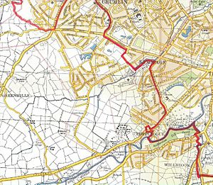
The Poddle starts as the Tymon River in the Cookstown area, northwest of Tallaght. It flows mostly underground at first. Its early open parts have been straightened. It passes by the Technological University Dublin campus and Tallaght Athletics track. Then it goes through Bancroft Park. The river continues east through Tymon North, past schools and St Aengus Church. It then reaches Tymon Lane, an old road that used to connect Templeogue and Greenhills.
Through Tymon Park
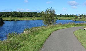
The river flows north into the western part of Tymon Park. This is a big public park created in the 1980s and 1990s. It flows past old castle sites and through small ponds, including a main one. Then it goes under the M50 orbital motorway into the eastern part of the park.
In this eastern section, more ponds were added, including one called Tymon Lake. This area will be changed to help control floods. It will become a flood capture area with a special wetland. The river then runs next to Limekiln Road and under Wellington Road. It forms the northern border of Templeogue and the southern border of Perrystown.
Near Templeville Road, the Poddle used to get water from an artificial stream. This stream, the first part of the City Watercourse, brought water from the River Dodder. This channel has been dry for over twenty years. The Poddle then flows into Kimmage. At Wainsfort Manor Green, there is a gate to control high water. If the water gets too high, some is sent into an underground pipe called the Lakelands Overflow.
The City Watercourse
For over 700 years, the Poddle's small flow was greatly increased. Water was taken from the River Dodder at a large weir in Firhouse. This water traveled three kilometers through the first part of the City Watercourse. Monks built this artificial channel by the 1240s. It helped supply water to Dublin. This watercourse has an interesting bend after Wellington Lane. It might have followed an old ditch around a church site.
Kimmage, Crumlin, and The Tongue
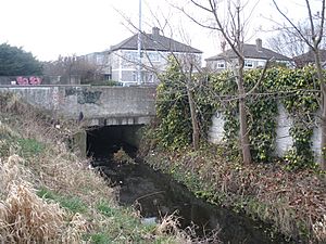
From where the City Watercourse joined, the river is known only as the Poddle. It flows northeast through Kimmage, even going under one of the buildings at Kimmage Manor. When the water level rises, it also flows into an underground pipe next to the main channel.
The Poddle passes Kimmage Crossroads and Poddle Park. It then reaches Sundrive Road in Crumlin. A shopping center now stands where an old mill used to be.
The river splits at an old structure called "The Tongue," near Mount Argus monastery in Harold's Cross. This is a stone wedge, also known as the "Stone Boat." It divides the water flow, sending two-thirds one way and one-third the other. The current "Stone Boat" is a modern copy of the original, built in 1245.
The smaller flow formed the second part of the man-made City Watercourse. It went north towards Crumlin Road and Dolphin's Barn. This channel passed the Grand Canal and went to the "City Basin" reservoir. This reservoir, built around 1670, was one of the first urban water reservoirs in Europe. It allowed many distilleries and breweries, like the St James’s Gate Brewery, to be built.
The larger flow continues along the original river bed. The Poddle passes the Russian Orthodox Church and runs along the edge of Mount Jerome Cemetery. It then goes underground in a culvert. It passes under the Grand Canal through a special pipe called a syphon. In 2020, it was confirmed that water still flows continuously through to the Liffey.
Lower Reaches
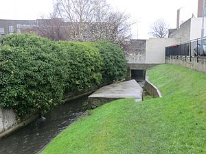
The river flows under much of the south city center in a culvert. Only one short part might still be open.
The main lower course is actually a diversion made in the 13th century. It was called the Abbey Mill Stream. This stream changed the Poddle's path to supply the Abbey of St Thomas a Beckett. The original Poddle course was lost. The Abbey Mill Stream later became known as the Earl of Meath's Watercourse.
After passing under the Grand Canal, the river bends northwest. It goes by Griffith College and the National Stadium. It travels under South Circular Road and comes to Donore Avenue. It then goes west to the Back of the Pipes area. Here, it passes over the Commons Water. Its course then runs parallel to parts of Marrowbone Lane. It reaches the site of St Thomas Abbey, south of Thomas Street.
The Poddle is joined by the Commons Water at the intersection of the Coombe and Patrick Street. Much of the lowest part of the Poddle is now in a large brick tunnel under the city streets and Dublin Castle. This section is walkable, and some writers have explored parts of it.
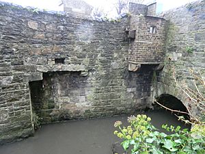
The Poddle enters Dublin Castle under the Ship Street Gate. It runs to the Chapel Royal and then turns sharply towards the Liffey. This is the area where the Black Pool once existed. The Poddle leaves the castle complex by the Palace Street Gate. A larger branch splits off towards City Hall and runs under Dame Street. The more direct line continues towards the Liffey, passing under the Olympia Theatre. Beyond the theatre, the two branches rejoin and flow north, under offices and the quay road.
The Poddle meets the Liffey at Wellington Quay. You can see its grated opening in the Liffey's stone walls at low tide.
How the Poddle Helped Dublin Grow
Early Importance
The Poddle was used as a boundary for land given by King John. One grant was to the Bishop of Dublin, John Comyn. The other was to the Abbey of St Thomas à Becket. The abbey built the Abbey Mill Stream diversion in the 13th century. This changed the Poddle's flow to supply the monastery.
However, the Poddle's natural flow was limited. So, in the early 13th century, a plan was made to take water from the Dodder. This water traveled through the 3km Firhouse-Kimmage City Watercourse. This greatly boosted the Poddle's flow, making up most of its water for much of the year.
Dublin's Water Supply
People were put in charge of making sure water flowed to Dublin. The "Stone Boat" that divided the flow was kept in good condition. The city paid for work on the Dodder weir. The Abbey of St Thomas received payments for this agreement.
Sometimes, people tried to stop the water supply. In 1534, rebels broke the supply lines. In 1597, the Talbots of Templeogue blocked the flow. Royalist forces did the same during the English Civil War. This left Cromwell's forces in Dublin without water or mills for food. Landowners also sometimes took more water than they were allowed.
Rules were made to manage the Poddle. People were not allowed to dump things into the water or wash clothes in it. Animals were not allowed to graze nearby. In 1718, pollution from paper and tuck mills was investigated. A law was passed to give Dublin Corporation more power over the Poddle. It also banned certain mills from the river system.
Changes and Replacements
The Abbey of St Thomas was closed in 1538. Its rights over the river passed to the Brabazon family. Dublin Corporation bought these rights in 1864.
As Dublin grew, the Poddle could not supply enough water for everyone. Water had to be rationed. Special city workers called turncocks opened and closed valves to different streets. They rang bells to tell people when water was available. From 1745, Dublin started getting water from other sources. Water was taken from the Liffey and later from the Grand Canal and Royal Canal.
Pollution and the End of the Dodder Link
Even when the Poddle was no longer used for drinking water, its flow had to be maintained for industries. Pollution increased greatly. One historian said the Poddle "formed an immense sewer." Another said it was "so polluted... that cattle and horses have died from drinking it."
The connection between the Dodder and Poddle was disturbed by new buildings in the 1970s. It was allowed to dry out in the late 20th century. Only a tiny part still carries water. There was talk about restoring it for historical reasons, but this has not happened.
Mills and Factories
The river provided water for many industries. These included brewing, distilling, and working with animal skins. It also powered many mills. By around 1300, there were at least six mills on the Poddle system. Later, there were many more. One list from 1879 had 40 mills on the Poddle system.
Industries supported by the Poddle and City Watercourse included:
- Paper mills and flour mills.
- Iron mills and cotton mills.
- Distilleries and breweries.
- Tanneries (for leather), glue factories, and bacon factories.
Protecting Dublin Castle
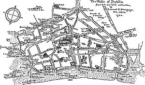
The Poddle naturally helped defend the south and east sides of Dublin Castle. A dam was built near the river's exit from the castle to make the water deeper. A ditch was dug along the castle's northern and western sides. The old town walls met the castle walls at the Poddle.
Famous Escapes
In 1592, Red Hugh O'Donnell and Art O'Neill escaped from Dublin Castle. They went through a drain into the Poddle, then out into the Liffey, and on to the Dublin Mountains. This escape is remembered with an annual trek into the mountains.
Dealing with Floods
Flooding in the Past
The Poddle once flowed near St Patrick's Street in two streams. The original St Patrick's Church was built between them, on what was called "the Island." This church became St Patrick's Cathedral in 1213. Historians wonder why it was built on marshy ground between two streams.
For centuries, the Poddle caused regular flooding and dampness in the cathedral and other buildings. Sometimes, the cathedral flooded to a depth of 5 feet. In 1701, flooding was so bad that people could use boats past the cathedral. Major floods also happened in 1778, 1791, and 1795. During a big reconstruction of the cathedral in the 19th century, the graves of Dean Jonathan Swift and Stella were moved because of the Poddle's flooding.
The Poddell Commission
A special group called the Poddell Commission was created to manage city center flooding from the river. This was especially important for St Patrick's Cathedral. The commission had staff and could take emergency action. It could also collect a special tax, called the Poddell Tax, to pay for its work.
The Poddell Tax was collected from people living near the cathedral and in areas at risk of flooding. The tax was later extended to Dublin Castle and businesses on streets connected to the Poddle. By 1836, the commission rarely met. In 1840, its powers were transferred to Dublin Corporation.
Modern Flood Control
There have been suburban floods more recently, in Harold's Cross and Kimmage in 1987, 1990, 1993, and 2011. After the 2011 floods, studies were done to find ways to manage the Poddle's flooding.
In 2020, plans for a Flood Alleviation Scheme were submitted. The plan aims to manage a 100-year flood. It includes building embankments in Tymon Park to create flood interception areas. It also involves building flood walls in many places. Other features include channel realignment and upgrading manholes.
Nature Around the Poddle
The river starts at about 92 meters above sea level and flows down to the Liffey at sea level. The Poddle is not one of the largest rivers in the Liffey system. But it is one of the best-known rivers in County Dublin.
Most of the Poddle's water comes from storm and surface water drainage. Its catchment area is about 16.4 square kilometers, mostly in urban areas. The ground beneath the Poddle is mostly limestone and shale.
The river does not have many fish because of its limited flow, pollution, and barriers. There are no salmon or other fish that are important for fishing. The water quality is often poor, with high nutrient levels.
The Poddle is considered a "highly-modified urban watercourse." Many parts of it have been artificially made. These include:
- The ponds in Tymon Park, including Tymon Lake.
- The Lakelands weir and overflow tunnel.
- The culverts and old mill works in Kimmage.
- The straightened course of the river through Ravensdale Park.
- The "Stone Boat" and all of the City Watercourse.
- The entire course from Mount Jerome Cemetery to the Liffey, including connected channels.
- The syphon and overflow structure at the Grand Canal.
Oversight
The Poddle flows within the areas managed by South Dublin County Council and Dublin City Council. The Office of Public Works helps with flooding concerns. The river does not have fixed gauges to measure its flow or depth. It has not been monitored for water quality since 2007.
See also
 In Spanish: Río Poddle para niños
 | Precious Adams |
 | Lauren Anderson |
 | Janet Collins |


