
Image: Ducie Map 1826 Beechey
No higher resolution available.
Ducie_Map_1826_Beechey.JPG (508 × 497 pixels, file size: 35 KB, MIME type: image/jpeg)
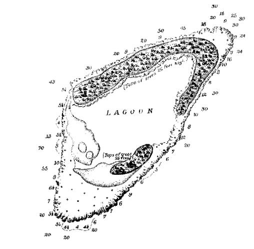
Description: Map of Ducie Island based on survey by Frederick William Beechey, part of Admiralty Chart 1176.
Title: Ducie Map 1826 Beechey
Credit: http://si-pddr.si.edu/jspui/bitstream/10088/5024/1/00183.pdf
Author: Frederick William Beechey
Permission: Piece reference FO 925/4419, Series reference FO 925
Usage Terms: Public domain
License: Public domain
Attribution Required?: No
Image usage
The following page links to this image:

All content from Kiddle encyclopedia articles (including the article images and facts) can be freely used under Attribution-ShareAlike license, unless stated otherwise.