
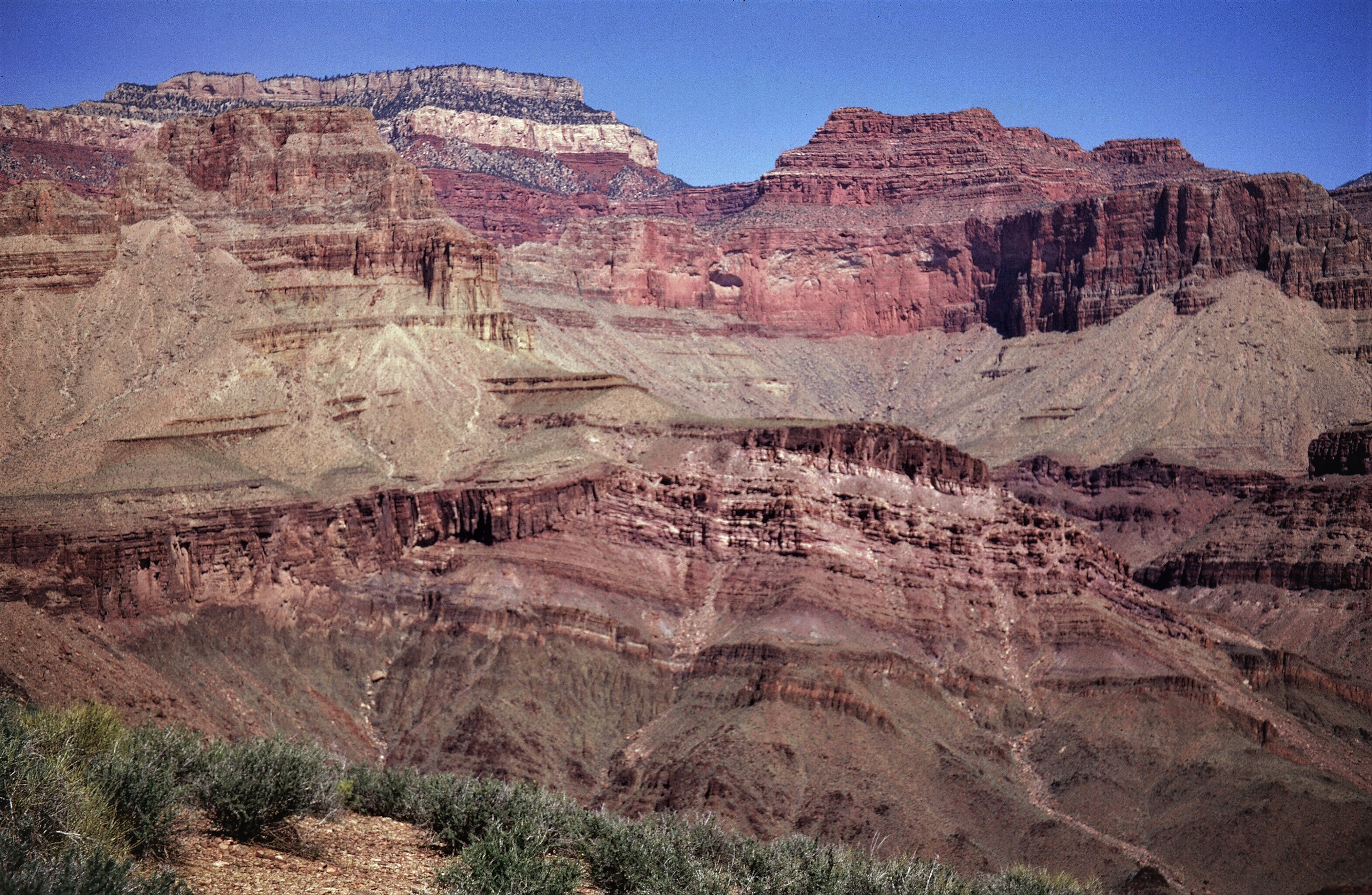
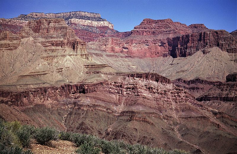
Image: Dutton Point and Masonic Temple
Size of this preview: 800 × 522 pixels. Other resolutions: 320 × 209 pixels | 4,187 × 2,731 pixels.
Original image (4,187 × 2,731 pixels, file size: 3.48 MB, MIME type: image/jpeg)
Description: View north into Shinumo Creek canyon toward Masonic Temple and Dutton Point (upper left) from Tonto Trail, south of river mile 110.0. Mesoproterozoic Unkar Group of rocks dip northeast and are unconformably onlapped by Cambrian Tapeats Sandstone.
Title: Dutton Point and Masonic Temple
Credit: https://www.sciencebase.gov/catalog/item/5c75aa4de4b0fe48cb4a59be
Author: George Billingsley, U.S. Geological Survey
Usage Terms: Public domain
License: Public domain
Attribution Required?: No
Image usage
The following 3 pages link to this image:

All content from Kiddle encyclopedia articles (including the article images and facts) can be freely used under Attribution-ShareAlike license, unless stated otherwise.