Powell Plateau (Arizona) facts for kids
Quick facts for kids Powell Plateau (Arizona) |
|
|---|---|

(an area adjacent Powell Plateau)
(Steamboat Mountain in the distance) |
|
| Highest point | |
| Elevation | 7,661 ft (2,335 m) |
| Prominence | 961 ft (293 m) |
| Isolation | 3.0 mi (4.8 km) |
| Parent peak | Kaibab Plateau (Swamp Point) |
| Geography | |
| Location | (West)-Grand Canyon National Park Coconino County, Arizona, US |
| Parent range | Kaibab Plateau Colorado Plateau |
| Topo map | USGS King Arthur Castle |
| Geology | |
| Age of rock | Permian |
| Mountain type | sedimentary rock: limestone, siltstone, mudstone, sandstone, shale |
| Type of rock | Kaibab Limestone, Toroweap Formation, Coconino Sandstone, Hermit Shale, Supai Group, Redwall Limestone, Muav Limestone, Bright Angel Shale |
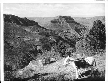
Powell Plateau is a large, flat-topped mountain located in the western part of the Grand Canyon in Arizona, USA. It stands tall at 7,661 feet (about 2,335 meters) above sea level. This impressive landform is named after John Wesley Powell, a famous American geologist and explorer who was one of the first to explore the Grand Canyon.
The plateau is quite large, covering about 300 acres (0.47 square miles). Its unique shape, especially a southwest arm, causes the Colorado River to make a big curve as it flows west. Powell Plateau is part of the Kaibab Plateau and the larger Colorado Plateau region.
Where is Powell Plateau?
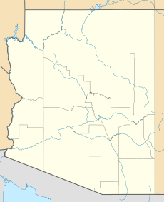
Powell Plateau is found in Coconino County, Arizona. It's about 13 miles (21 kilometers) northwest of Grand Canyon Village, which is a popular spot for visitors. The plateau is a key feature within the Grand Canyon National Park.
Exploring the Plateau
The eastern side of Powell Plateau is drained by a stream called White Creek, which flows through Muav Canyon. This area is also home to the North Bass Trail, a path that hikers can use to explore parts of the Grand Canyon.
The highest point of Powell Plateau is at its northern end. This spot is directly across from Swamp Point on the North Rim of the Grand Canyon. The plateau also has different arms, or sections, that extend out. The southeast arm reaches a height of 7,538 feet, while the southwest arm is 6,883 feet high.
How Powell Plateau Formed
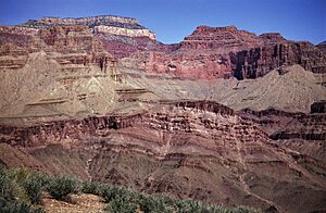
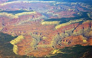
Powell Plateau is made up of different types of sedimentary rock. These rocks formed over millions of years from layers of sand, mud, and ancient sea creatures that settled and hardened. The main types of rock found here include limestone, siltstone, mudstone, sandstone, and shale.
Some of the specific rock layers you can find at Powell Plateau include:
- Kaibab Limestone
- Toroweap Formation
- Coconino Sandstone
- Hermit Shale
- Supai Group
- Redwall Limestone
- Muav Limestone
- Bright Angel Shale
These rock layers were mostly formed during the Permian period, which was about 299 to 252 million years ago. Over time, the Colorado River and other natural forces carved away the softer rocks, leaving behind the harder layers that form the plateau we see today.
 | Calvin Brent |
 | Walter T. Bailey |
 | Martha Cassell Thompson |
 | Alberta Jeannette Cassell |


