
Image: EAfrica
No higher resolution available.
EAfrica.png (454 × 382 pixels, file size: 42 KB, MIME type: image/png)
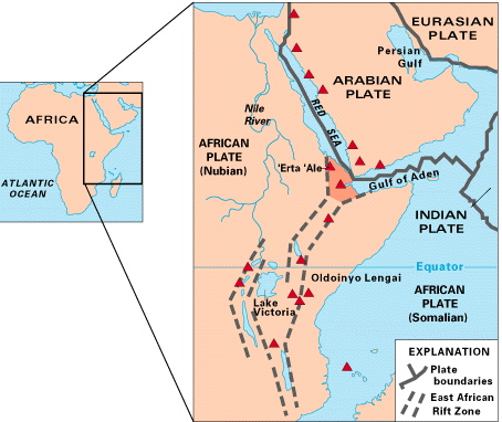
Description: Map of East Africa showing some of the historically active volcanoes(red triangles) and the Afar Triangle (shaded, center) -- a so-called triple junction (or triple point), where three plates are pulling away from one another: the Arabian Plate, and the two parts of the African Plate (the Nubian and the Somalian) splitting along the East African Rift Zone.
Title: EAfrica
Credit: http://pubs.usgs.gov/gip/dynamic/East_Africa.html
Author: USGS
Usage Terms: Public domain
License: Public domain
Attribution Required?: No
Image usage
The following 3 pages link to this image:

All content from Kiddle encyclopedia articles (including the article images and facts) can be freely used under Attribution-ShareAlike license, unless stated otherwise.