
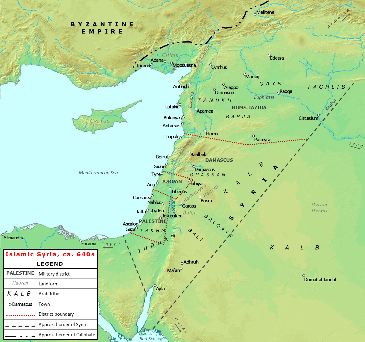
Image: Early Islamic Syria, ca. 640s
Description: Map of Islamic Syria (Bilad al-Sham) under the Rashidun caliphs Umar and Uthman. The map shows the approximate boundaries of Syria's military districts before their reorganization during the Umayyad and Abbasid caliphates, the region's major towns during this period, and the territories of the major resident Arab tribes before the mass tribal migrations from Arabia during the governorship of Mu'awiya ibn Abi Sufyan (639-661). Sources for tribes and approximate district boundaries: Donner, Fred M. (1981). The Early Islamic Conquests. Princeton: Princeton University Press ISBN 0-691-05327-8 Hinds, M. (1993). "Muʿāwiya I b. Abī Sufyān". In Bosworth, C. E.; van Donzel, E.; Heinrichs, W. P. & Pellat, Ch. (eds.). The Encyclopaedia of Islam, New Edition, Volume VII: Mif–Naz. Leiden: E. J. Brill. pp. 263–268. ISBN 90-04-09419-9. Sourdel, D. (1965). "Filasṭīn — I. Palestine under Islamic Rule". In Lewis, B.; Pellat, Ch. & Schacht, J. (eds.). The Encyclopaedia of Islam, New Edition, Volume II: C–G. Leiden: E. J. Brill. pp. 910–913. ISBN 90-04-07026-5.
Title: Early Islamic Syria, ca. 640s
Credit: Own work
Author: Al Ameer son
Usage Terms: Creative Commons Attribution-Share Alike 4.0
License: CC BY-SA 4.0
License Link: https://creativecommons.org/licenses/by-sa/4.0
Attribution Required?: Yes
Image usage
The following 2 pages link to this image:
