
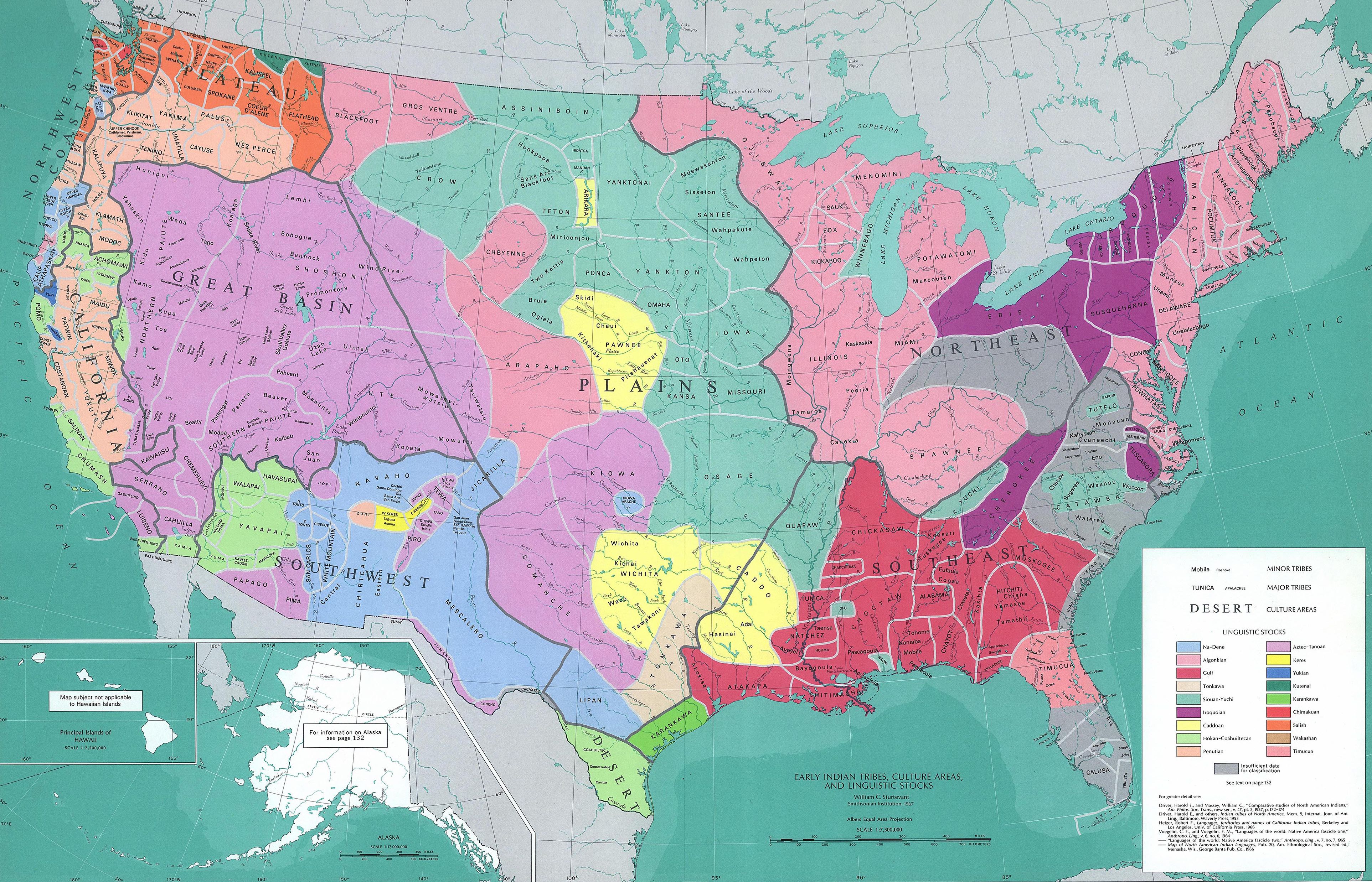
Image: Early Localization Native Americans USA
Size of this preview: 800 × 514 pixels. Other resolutions: 320 × 206 pixels | 3,850 × 2,476 pixels.
Original image (3,850 × 2,476 pixels, file size: 2.13 MB, MIME type: image/jpeg)
Description: Map reconstituting the geographic culture areas of the early Native American tribes and the different Amerindian languages that were spoken in the USA.
Title: Early Localization Native Americans USA
Credit: 1967 USGS map.
Author: William C. Sturtevant, Smithsonian Institute, 1967
Permission: This image is in the public domain in the United States because it only contains materials that originally came from the United States Geological Survey, an agency of the United States Department of the Interior. For more information, see the official USGS copyright policy.
Usage Terms: Public domain
License: Public domain
Attribution Required?: No
Image usage
The following 3 pages link to this image:

All content from Kiddle encyclopedia articles (including the article images and facts) can be freely used under Attribution-ShareAlike license, unless stated otherwise.