
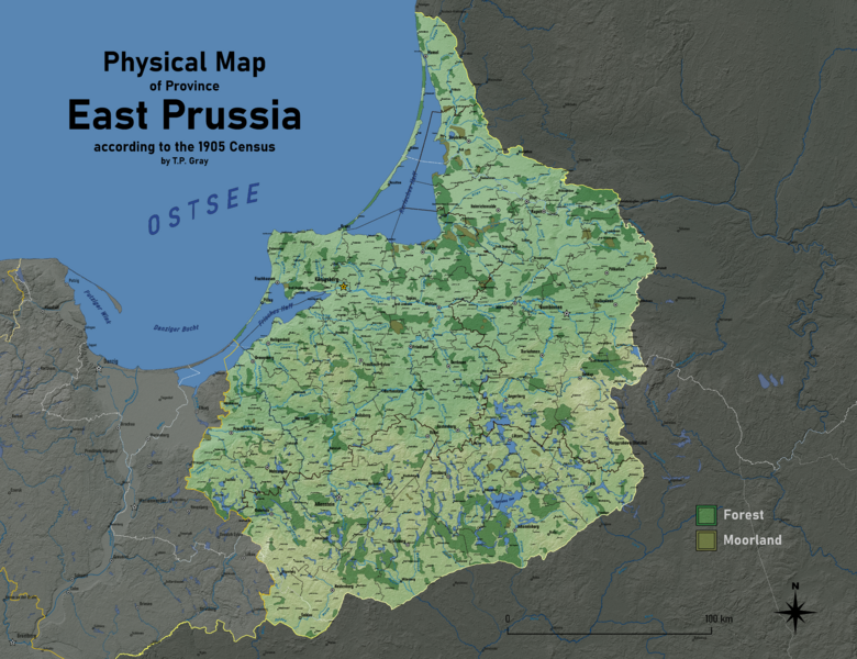
Image: East Prussia Physical Map

Size of this preview: 780 × 600 pixels. Other resolutions: 312 × 240 pixels | 9,200 × 7,075 pixels.
Original image (9,200 × 7,075 pixels, file size: 36.06 MB, MIME type: image/png)
Description: Physical map of East Prussia in 1905, with cities and towns, political boundaries, rivers and water-bodies, and forests/moorlands indicated. SRTM data for relief and topography from from U.S. Geological Survey, National Geospatial Program.
Title: East Prussia Physical Map
Credit: Own work
Author: Ascended Dreamer
Usage Terms: Creative Commons Attribution-Share Alike 4.0
License: CC BY-SA 4.0
License Link: https://creativecommons.org/licenses/by-sa/4.0
Attribution Required?: Yes
Image usage
The following page links to this image:

All content from Kiddle encyclopedia articles (including the article images and facts) can be freely used under Attribution-ShareAlike license, unless stated otherwise.