
Image: East vs West Coast Earthquakes USGS
Size of this preview: 720 × 600 pixels. Other resolutions: 288 × 240 pixels | 3,600 × 3,000 pixels.
Original image (3,600 × 3,000 pixels, file size: 1.75 MB, MIME type: image/jpeg)
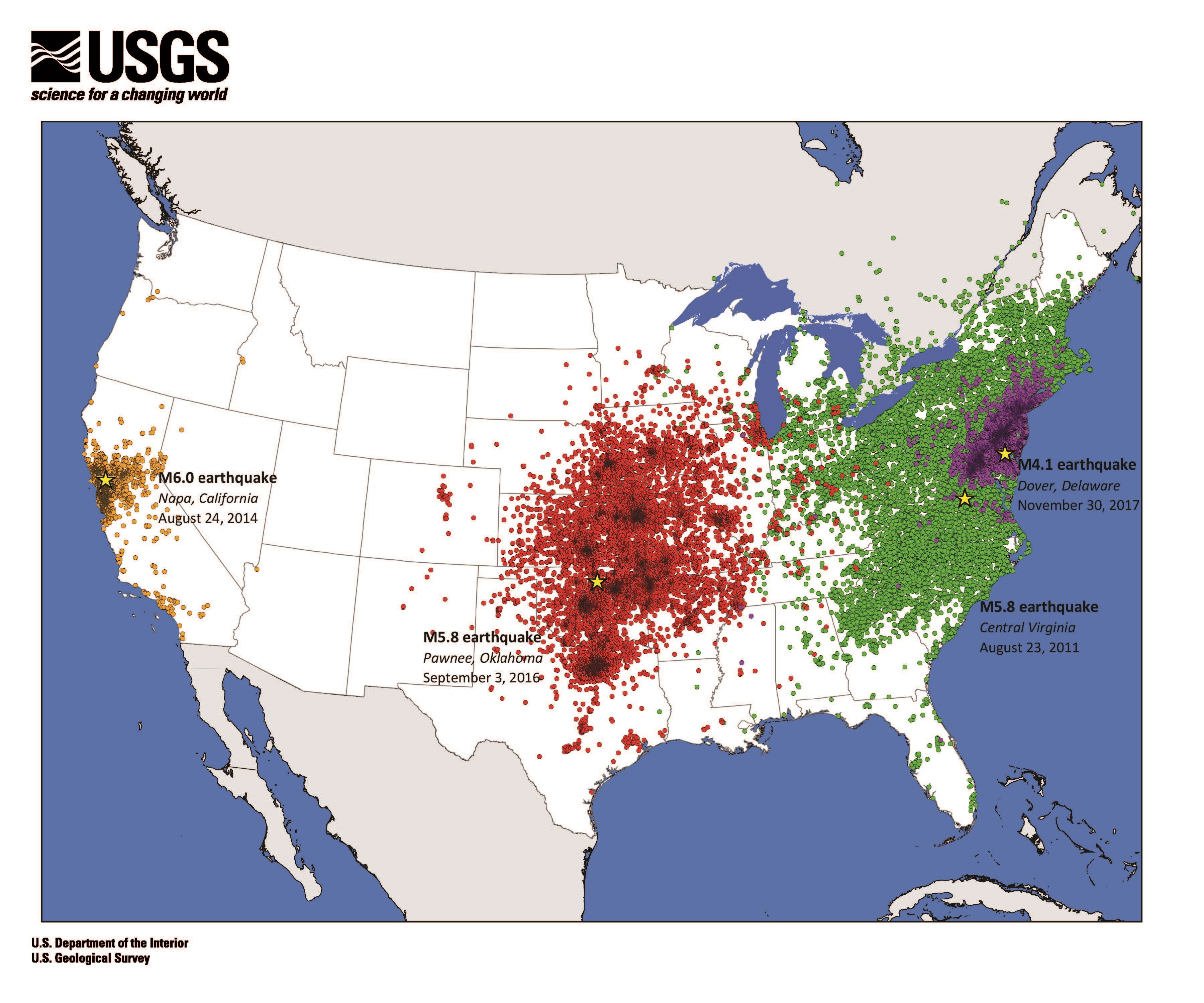
Description: Map of USGS "Did You Feel It?" data shows that earthquakes east of the Rocky Mountains are felt over larger areas than earthquakes in the West. [1]
Title: East vs West Coast Earthquakes USGS
Credit: https://prd-wret.s3-us-west-2.amazonaws.com/assets/palladium/production/s3fs-public/thumbnails/image/DYFI_eq_Dover%20JPEG.jpg
Author: Eric Jones, USGS
Usage Terms: Public domain
License: Public domain
Attribution Required?: No
Image usage
The following page links to this image:

All content from Kiddle encyclopedia articles (including the article images and facts) can be freely used under Attribution-ShareAlike license, unless stated otherwise.