
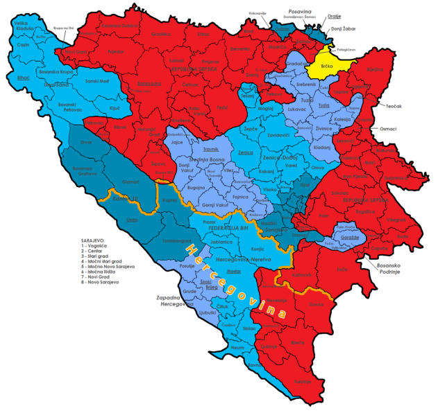
Image: Economic region of Herzegovina

Description: Map of the political division of Bosnia and Herzegovina; shows Federation Bih (blue) with cantons (different colours), Republika Srpska (red), Brčko district (yellow) and all municipalities with their official names. The Economical Region of Herzegovina is highlighted in orange.
Title: Economic region of Herzegovina
Credit: This file was derived from: Bosnia and Herzegovina Political.png (Map) Economic Region of Herzegovina: Razvijena ekonomska regija. REDAH.
Author: Bosnia_and_Herzegovina_Political.png: j.budissin (Julian Nitzsche) derivative work: NordNordWest (talk · contribs)
Usage Terms: Creative Commons Attribution-Share Alike 3.0
License: CC BY-SA 3.0
License Link: https://creativecommons.org/licenses/by-sa/3.0
Attribution Required?: Yes
Image usage
The following page links to this image:
