
Image: Edinburgh town walls

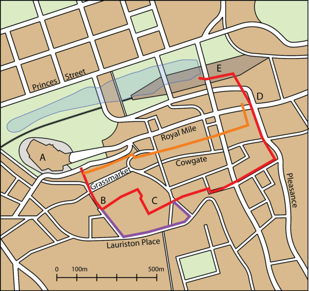
Description: A map of central Edinburgh, showing the locations of the town walls, overlaid on the present day street pattern. Note not all streets are shown. Key: A: Edinburgh Castle B: Flodden Tower C: Greyfriars Kirkyard D: Netherbow Port E: Waverley station Orange line: King's Wall (c.1450-1475) Red line: Flodden Wall (c.1514-1560) Purple line: Telfer Wall (c.1620) Blue hatching shows approximate extent of the former Nor Loch
Title: Edinburgh town walls
Credit: Own work Based on File:Edinburgh map.png
Author: Jonathan Oldenbuck
Permission: You may select the license of your choice.
Usage Terms: Creative Commons Attribution-Share Alike 3.0
License: CC BY-SA 3.0
License Link: https://creativecommons.org/licenses/by-sa/3.0
Attribution Required?: Yes
Image usage
The following page links to this image:
