
Image: EdwardWright-MapforSailingtoAzores-1599
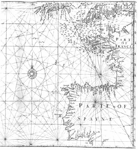
Description: English mathematician and cartographer Edward Wright's map "for sailing to the Isles of Azores", which was constructed according to the Mercator projection which Wright explained in his work Certaine Errors of Navigation (1599). The star-like grid of lines are loxodromes or rhumb lines.
Title: EdwardWright-MapforSailingtoAzores-1599
Credit: Edward Wright (1599) Certaine Errors in Navigation, arising either of the Ordinarie Erroneous Making or Vsing of the Sea Chart, Compasse, Crosse Staffe, and Tables of Declination of the Sunne, and Fixed Starres Detected and Corrected. (The Voyage of the Right Ho. George Earle of Cumberl. to the Azores, &c.), London: Printed ... by Valentine Simmes Reproduced as fig. 2.10 of Paul J. Lewi (2006-02-11) "Mercator, Wright and Mapmaking" in Speaking of Graphics: An Essay on Graphicacy in Science, Technology and Business, Turnhout, Belgium: DataScope, pp. 30
Author: Edward Wright
Usage Terms: Public domain
License: Public domain
Attribution Required?: No
Image usage
The following 2 pages link to this image:
