
Image: Entradas de Péten

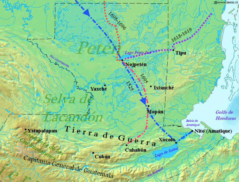
Description: Map of the Spanish entry routes to Petén in Guatemala during the 17th century in the lead up to the conquest of the Petén lakes region in 1697, with the approximate route of Hernán Cortés 1525. Entradas 1525 Hernán Cortés 1618-1619 Friars Fuensalida and Orbita 1695 Friar Cano and Captain Díaz de Velasco 1695-1696 Friar Avendaño y Loyola Contact period name and modern equivalent Ixtanché = Dolores, Petén Mopán = San Luis, Petén Nojpetén = Flores, Petén Xocolo = San Felipe, Izabal Ystapalapan = San Mateo Ixtatán, Huehuetenango Yaxché = Sayaxché, Petén Sources: Lost Shores, Forgotten Peoples: Spanish Explorations of the South East Maya Lowlands by Lawrence H. Feldman 2000 The Kowoj: Identity, Migration and Geopolitics in Late Postclassic Petén, Guatemala by Rice & Rice 2009 La Conquista del Lacandón by Nuria Pons Sáez 1997 The Location of Tayasal: A Reconsideration in Light of Peten Maya Ethnohistory and Archaeology by Jones, Grant D.; Don S. Rice and Prudence M. Rice (July 1981). History of the Spanish Conquest of Yucatan and of the Itzas by Philip Ainsworth Means, 1917 The Conquest of the Last Maya Kingdom by Grant D. Jones, 1998
Title: Entradas de Péten
Credit: Map_of_Guatemala_Demis.png
Author: Map_of_Guatemala_Demis.png: Demis derivative work: Simon Burchell (talk)
Usage Terms: Creative Commons Attribution-Share Alike 3.0
License: CC BY-SA 3.0
License Link: https://creativecommons.org/licenses/by-sa/3.0
Attribution Required?: Yes
Image usage
The following page links to this image:
