
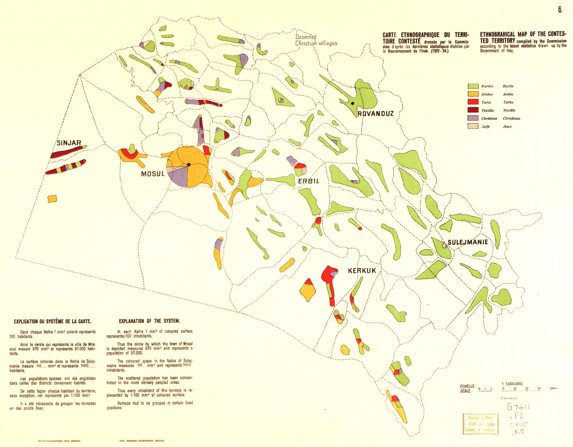
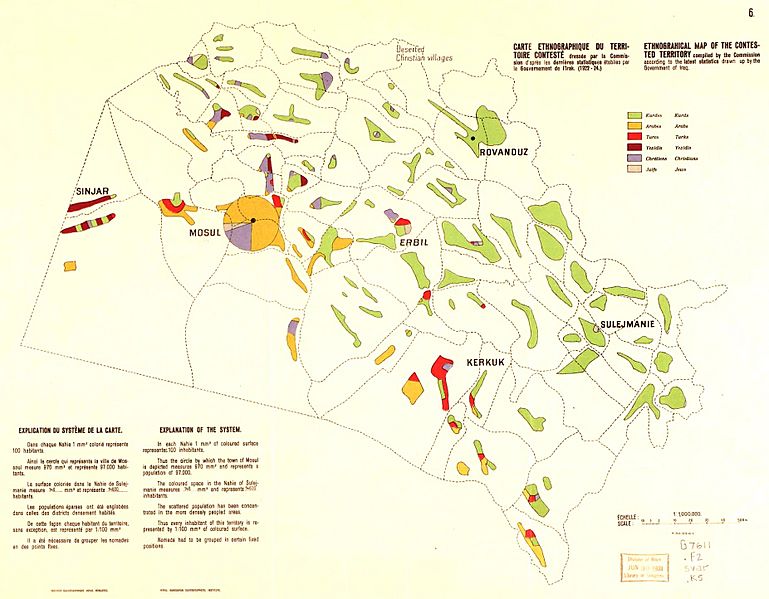
Image: Ethnographical Map of the contested territory (1922-1924) (Mosul vilayet)
Description: Ethnographical Map of the contested territory, compiled by the Commission according to the latest statistics drawn up by the Government of Iraq (1922-1924). Source: Map 6 of Question of the frontier between Turkey and Iraq, League of Nations, C400M147 1925VII. Geneva.
Title: Ethnographical Map of the contested territory (1922-1924) (Mosul vilayet)
Credit: https://biblio-archive.unog.ch/Dateien/CouncilMSD/C-400-M-147-1925-VII_BI.pdf colored version available https://www.brandeis.edu/crown/publications/cp/CP7.pdf
Author: E. af Wirsén, Paul Teleki (cartography), A. Paulais, Commission instituted by the Council Resolution of September 30th, 1924, League of Nations
Usage Terms: Public domain
License: Public domain
Attribution Required?: No
Image usage
The following page links to this image:

_(Mosul_vilayet).jpg)