
Image: Eurasian borders
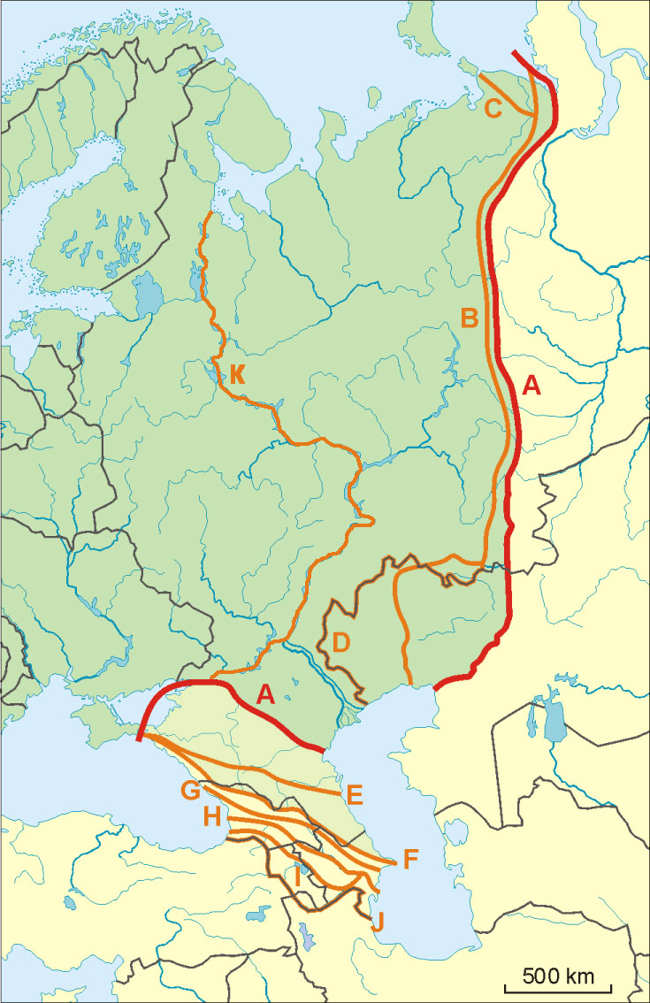
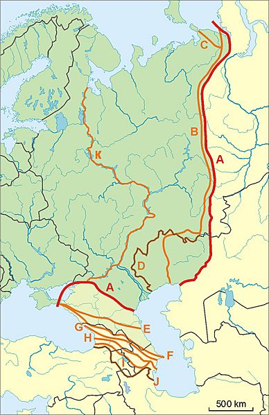
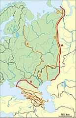
Description: Map of Europe (green) - Asia (yellow) border. Red line - border accoring to International Geographical Union and most European geographers. A: Ural Mountains-Emba River and Kuma Manyche Depression-Lower Don Orange lines - other variants of border: B: Ural Montains-Ural River C: Ural Mountains-Pechora River D: Ural Mountains-Kazakhstan Border E: Kuma Manyche Depression (at Rivers Kuma and Manyche) F and G: Lines on the Grear Caucasus watershed H: Meso-Caucasus at Rivers Rioni and Kura I and J: Lines on the Lesser Caucasus K: Miles Clark's circumnavigation of Europe route through Russian waterways
Title: Eurasian borders
Credit: Own work
Author: Aotearoa
Usage Terms: Creative Commons Attribution-Share Alike 4.0
License: CC BY-SA 4.0
License Link: https://creativecommons.org/licenses/by-sa/4.0
Attribution Required?: Yes
Image usage
The following page links to this image:
