
Image: Europe-south-west-kingdoms12th

Size of this preview: 766 × 600 pixels. Other resolutions: 307 × 240 pixels | 834 × 653 pixels.
Original image (834 × 653 pixels, file size: 440 KB, MIME type: image/png)
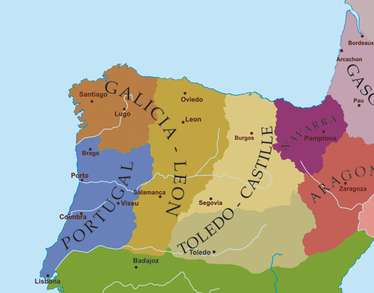
Description: Mapa político do noroeste da Península Ibérica a finais do século XII.
Title: Europe-south-west-kingdoms12th
Credit: Transferred from gl.wikipedia to Commons.
Author: The original uploader was Alexandre Vigo at Galician Wikipedia
Usage Terms: Creative Commons Attribution-Share Alike 3.0
License: CC-BY-SA-3.0
License Link: http://creativecommons.org/licenses/by-sa/3.0/
Attribution Required?: Yes
Image usage
The following page links to this image:

All content from Kiddle encyclopedia articles (including the article images and facts) can be freely used under Attribution-ShareAlike license, unless stated otherwise.