
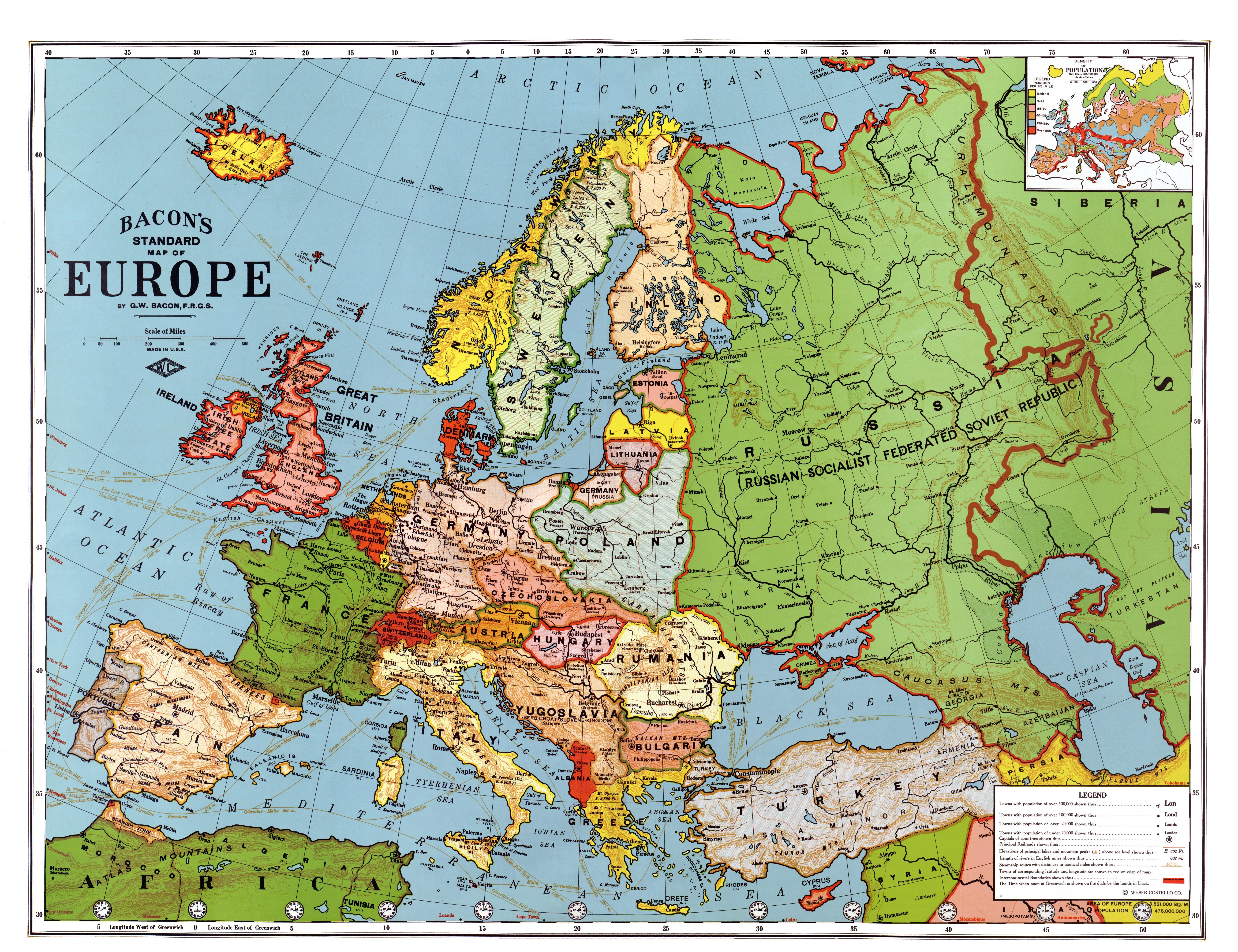
Image: Europe in 1923
Description: Bacon's standard map of Europe, 1923. Relief shown by hachures and spot heights. Shows steamship routes and time zones. Published by Weber Costello Co., 84 x 111 cm. Scale 1:5,500,000 (W 52°--E 80°/N 60°--N 30°).
Title: Europe in 1923
Credit: This map is available from the United States Library of Congress's Geography & Map Division under the digital ID g5700.ct001973. This tag does not indicate the copyright status of the attached work. A normal copyright tag is still required. See Commons:Licensing for more information. العربية | čeština | Deutsch | English | español | فارسی | suomi | français | magyar | italiano | македонски | മലയാളം | Nederlands | polski | português | русский | slovenčina | slovenščina | Türkçe | українська | 中文 | 中文(简体) | 中文(繁體) | +/−
Author: Bacon, George Washington (1830-1921)
Usage Terms: Public domain
License: Public domain
Attribution Required?: No
Image usage
The following 2 pages link to this image:
