
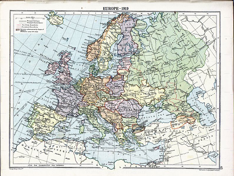
Image: Europe map 1919

Size of this preview: 795 × 600 pixels. Other resolutions: 318 × 240 pixels | 1,996 × 1,506 pixels.
Original image (1,996 × 1,506 pixels, file size: 1.39 MB, MIME type: image/jpeg)
Description: Map of en:Europe political divisions in 1919 (after the treaties of Brest-Litovsk and Versailles and before the treaties of Trianon, Riga, Kars and the establishment of en:Soviet Union and the republics of Ireland and Turkey) published by London Geographical Institute. This uploaded map is a photoshopped version of the original image located at hipkiss.org. According to the site, there are no copyrights to this map.
Title: Europe map 1919
Usage Terms: Public domain
License: Public domain
Attribution Required?: No
Image usage
The following 2 pages link to this image:

All content from Kiddle encyclopedia articles (including the article images and facts) can be freely used under Attribution-ShareAlike license, unless stated otherwise.