
Image: FLII EquatorialGuinea

Size of this preview: 732 × 600 pixels. Other resolutions: 293 × 240 pixels | 1,085 × 889 pixels.
Original image (1,085 × 889 pixels, file size: 159 KB, MIME type: image/png)
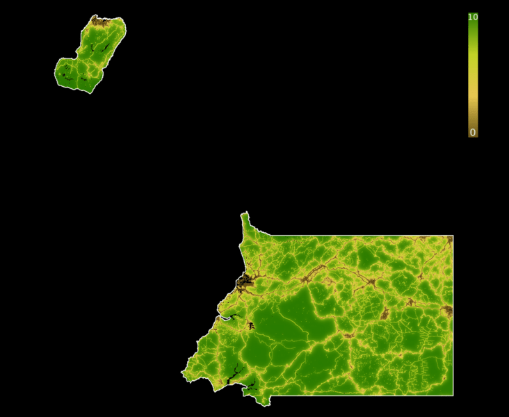
Description: Forest Landscape Integrity Index 2019 map of Equatorial Guinea. Forest condition measured by degree of anthropogenic modification. 0 = Most modification; 10= Least. Created in Google Earth Engine. National boundaries = LSIB 2017: Large Scale International Boundary Polygons, Detailed, US Officer of the Geographer
Title: FLII EquatorialGuinea
Credit: Own work
Author: PhnomPencil
Usage Terms: Creative Commons Attribution-Share Alike 4.0
License: CC BY-SA 4.0
License Link: https://creativecommons.org/licenses/by-sa/4.0
Attribution Required?: Yes
Image usage
The following page links to this image:

All content from Kiddle encyclopedia articles (including the article images and facts) can be freely used under Attribution-ShareAlike license, unless stated otherwise.