
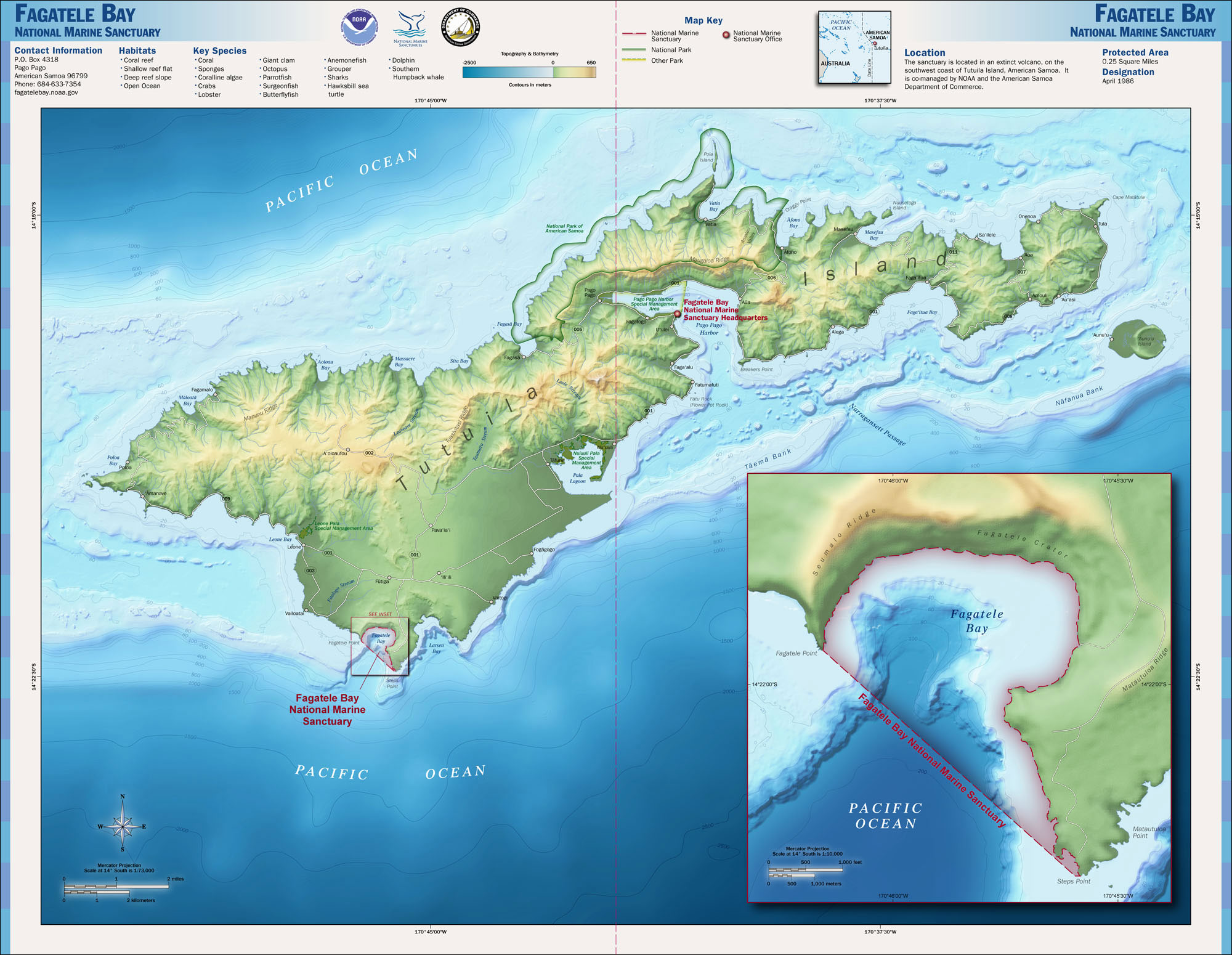
Image: Fagatele Bay NMS map
Size of this preview: 774 × 600 pixels. Other resolutions: 310 × 240 pixels | 2,000 × 1,550 pixels.
Original image (2,000 × 1,550 pixels, file size: 503 KB, MIME type: image/jpeg)
Description: Map of the Fagatele Bay National Marine Sanctuary in American Samoa.
Title: Fagatele Bay NMS map
Credit: http://www.sanctuaries.noaa.gov/pgallery/atlasmaps/
Author: National Oceanic and Atmospheric Administration
Usage Terms: Public domain
License: Public domain
Attribution Required?: No
Image usage
The following page links to this image:

All content from Kiddle encyclopedia articles (including the article images and facts) can be freely used under Attribution-ShareAlike license, unless stated otherwise.