
Image: Falkland-Islands-Map-1827

Size of this preview: 800 × 481 pixels. Other resolutions: 320 × 192 pixels | 1,849 × 1,112 pixels.
Original image (1,849 × 1,112 pixels, file size: 5.89 MB, MIME type: image/png)
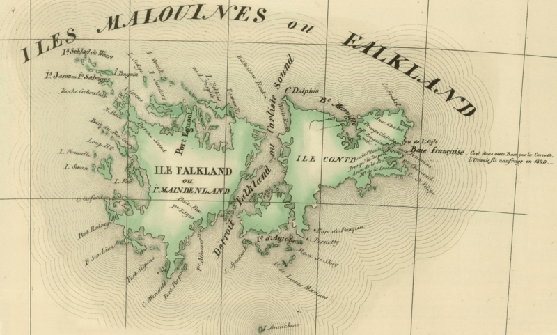
Description: A French map of the Falkland Islands from 1827. It identifies Port Egmont still, but Puerto de la Soledad has ceased to be marked. It uses an interesting mix of predominantly French and English names – often giving alternative names in the two languages. The sound is marked as Detroit Falkland or Carlisle Sound for example. It also marks the point in 1820 that the Uranus was shipwrecked off the islands.
Title: Falkland-Islands-Map-1827
Credit: The British Empire: Falkland Islands. Îles Malouines ou Falkland. 1827
Author: AnonymousUnknown author
Usage Terms: Public domain
License: Public domain
Attribution Required?: No
Image usage
The following page links to this image:

All content from Kiddle encyclopedia articles (including the article images and facts) can be freely used under Attribution-ShareAlike license, unless stated otherwise.