
Image: Feb 7 09 vic bushfires map

Size of this preview: 800 × 559 pixels. Other resolutions: 320 × 224 pixels | 816 × 570 pixels.
Original image (816 × 570 pixels, file size: 15 KB, MIME type: image/png)
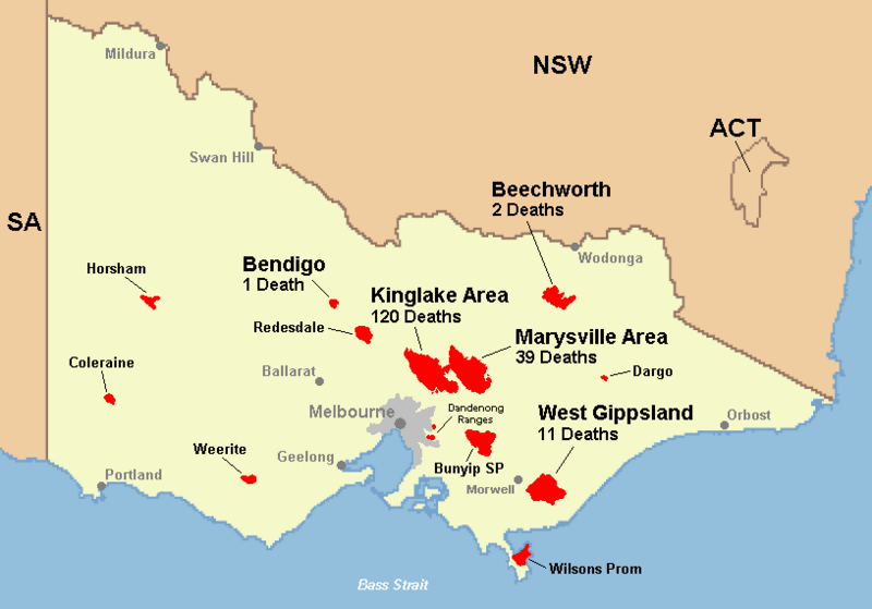
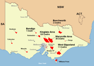
Description: location-wise death toll in Victoria during Black Saturday bushfire 2009
Title: Feb 7 09 vic bushfires map
Credit: Own work
Author: Nick carson at English Wikipedia
Usage Terms: Public domain
License: Public domain
Attribution Required?: No
Image usage
The following page links to this image:

All content from Kiddle encyclopedia articles (including the article images and facts) can be freely used under Attribution-ShareAlike license, unless stated otherwise.