
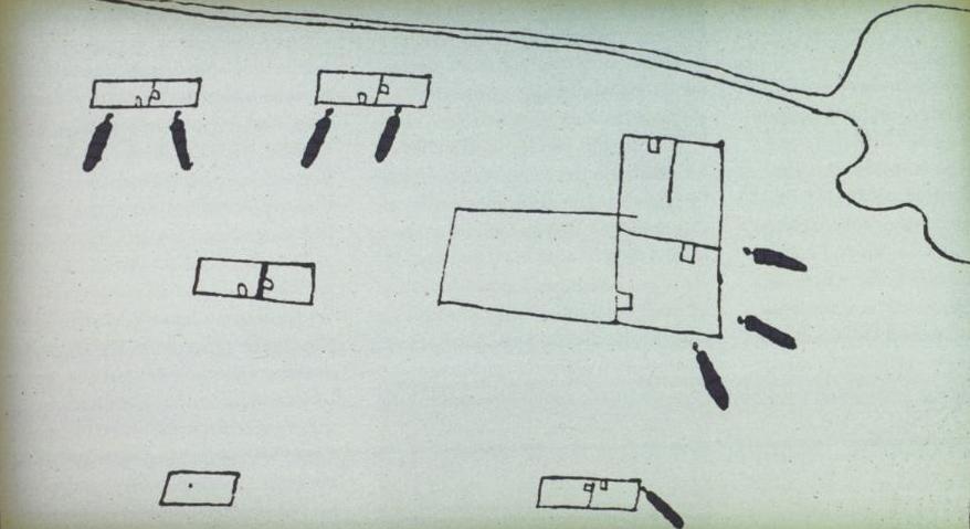
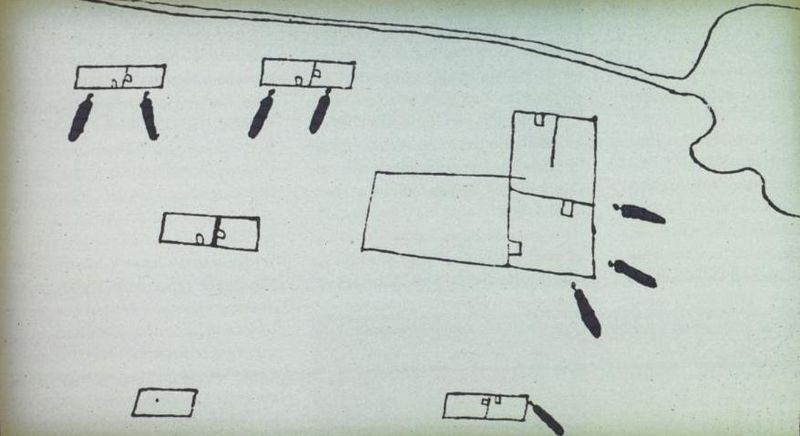
Image: Fort Saint Louis by Alonso DeLeon
Size of this preview: 800 × 436 pixels. Other resolutions: 320 × 175 pixels | 878 × 479 pixels.
Original image (878 × 479 pixels, file size: 40 KB, MIME type: image/jpeg)
Description: This is a map of Fort Saint Louis as it looked in 1689. The map was included in Relacion y Discursos de Descubrimiento, written by Alonso De Leon in the 1690s.
Title: Fort Saint Louis by Alonso DeLeon
Credit: reprinted in From a Watery Grave: The Discovery and Excavation of La Salle's Shipwreck, La Belle by James E. Bruseth and toni S. Turner (2005), Texas A&M University Press
Author: Alonso De Leon
Usage Terms: Public domain
License: Public domain
Attribution Required?: No
Image usage
The following 2 pages link to this image:

All content from Kiddle encyclopedia articles (including the article images and facts) can be freely used under Attribution-ShareAlike license, unless stated otherwise.